betterboating.vic.gov.au · Government
Safer access ramp and rebuilt low landing for recreational water users.
Shallow pier dive with strong night macro life.
Shallow pier dive with strong night macro life.
Save it, log a dive, or explore nearby on the map.
Save it to come back later
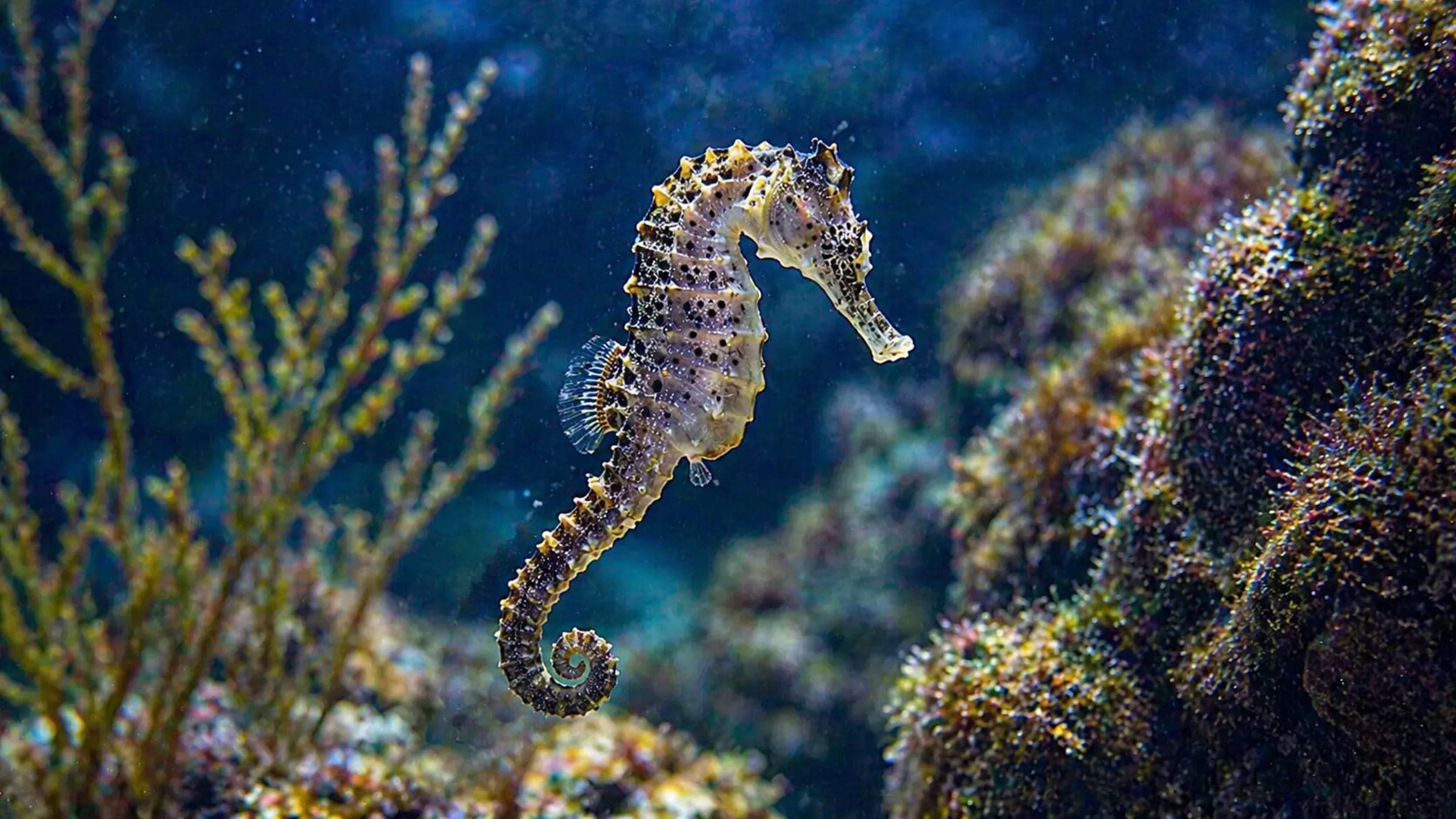
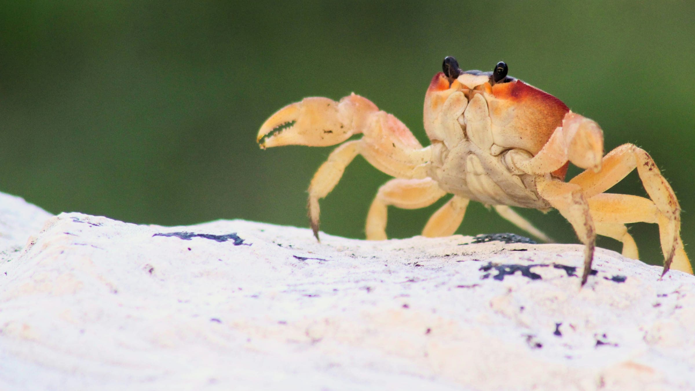
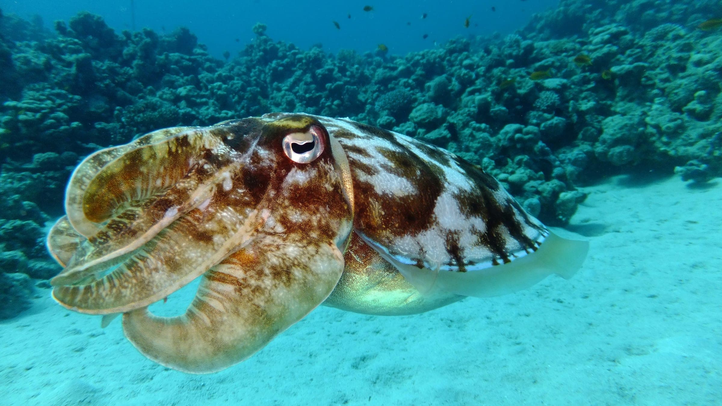
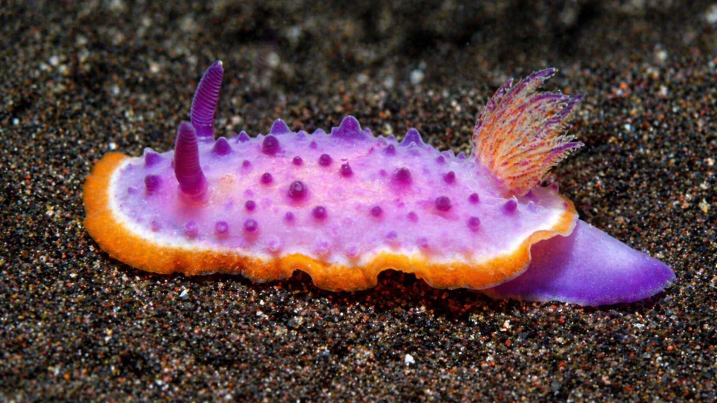
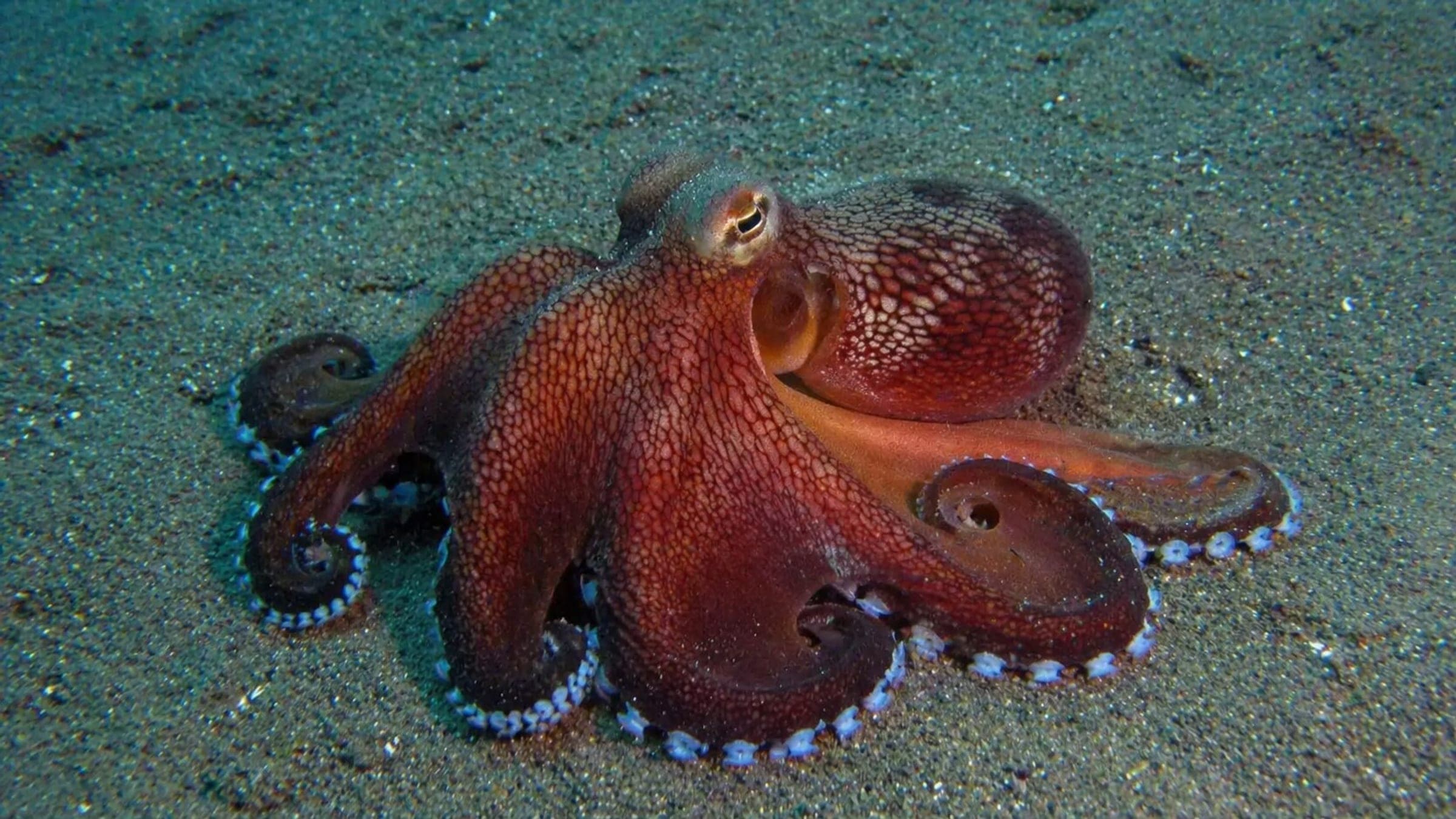
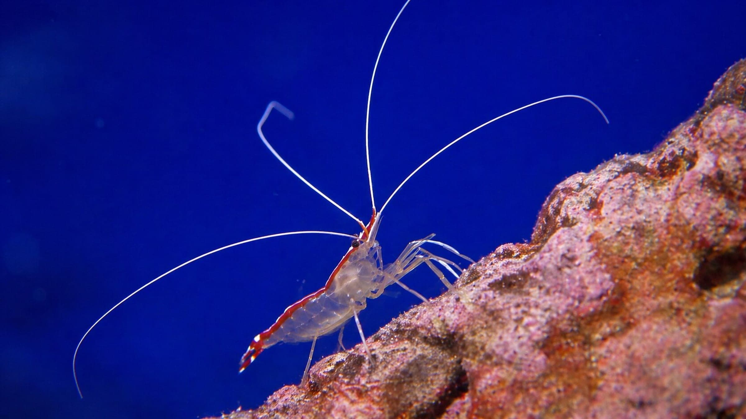
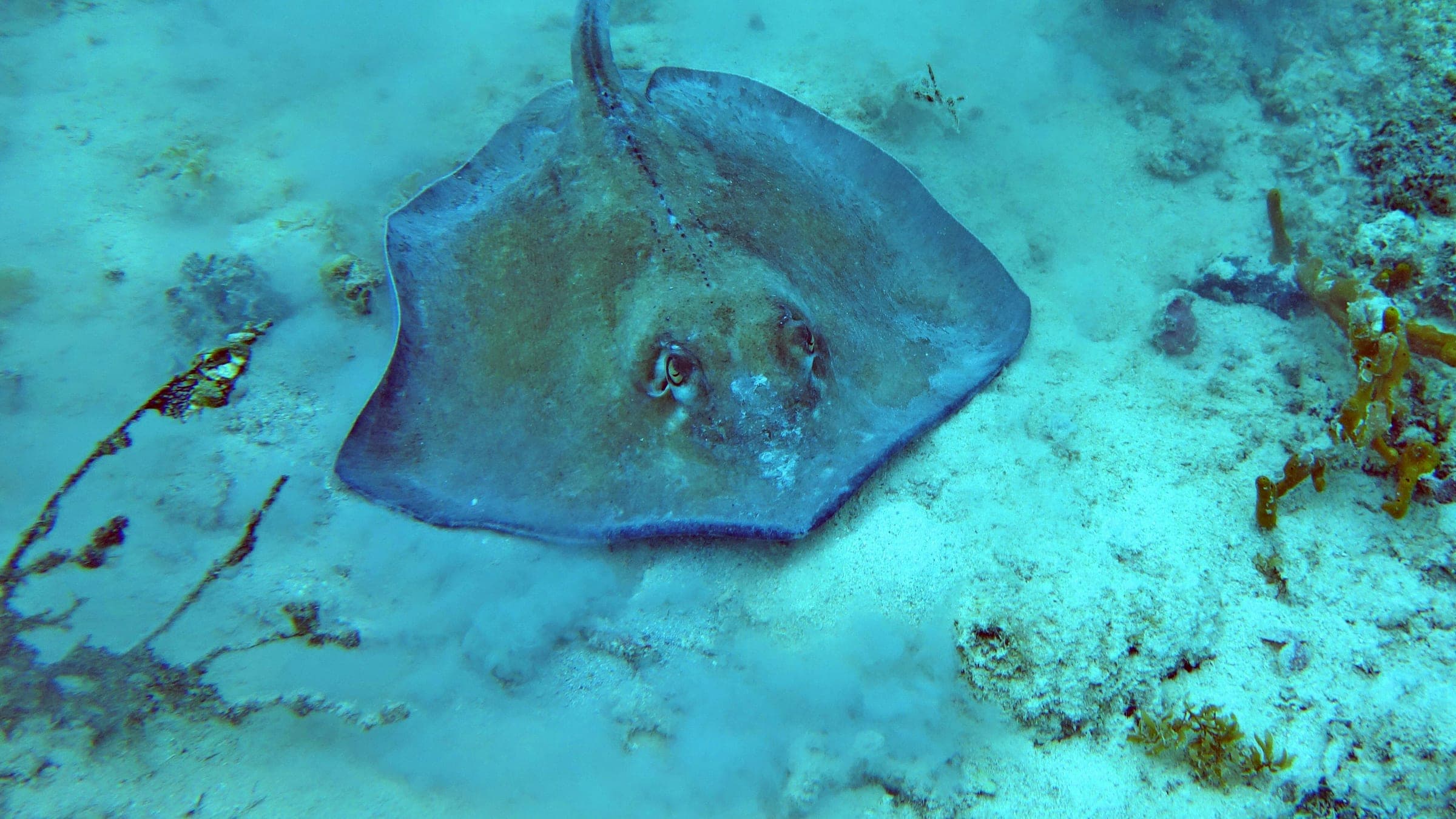
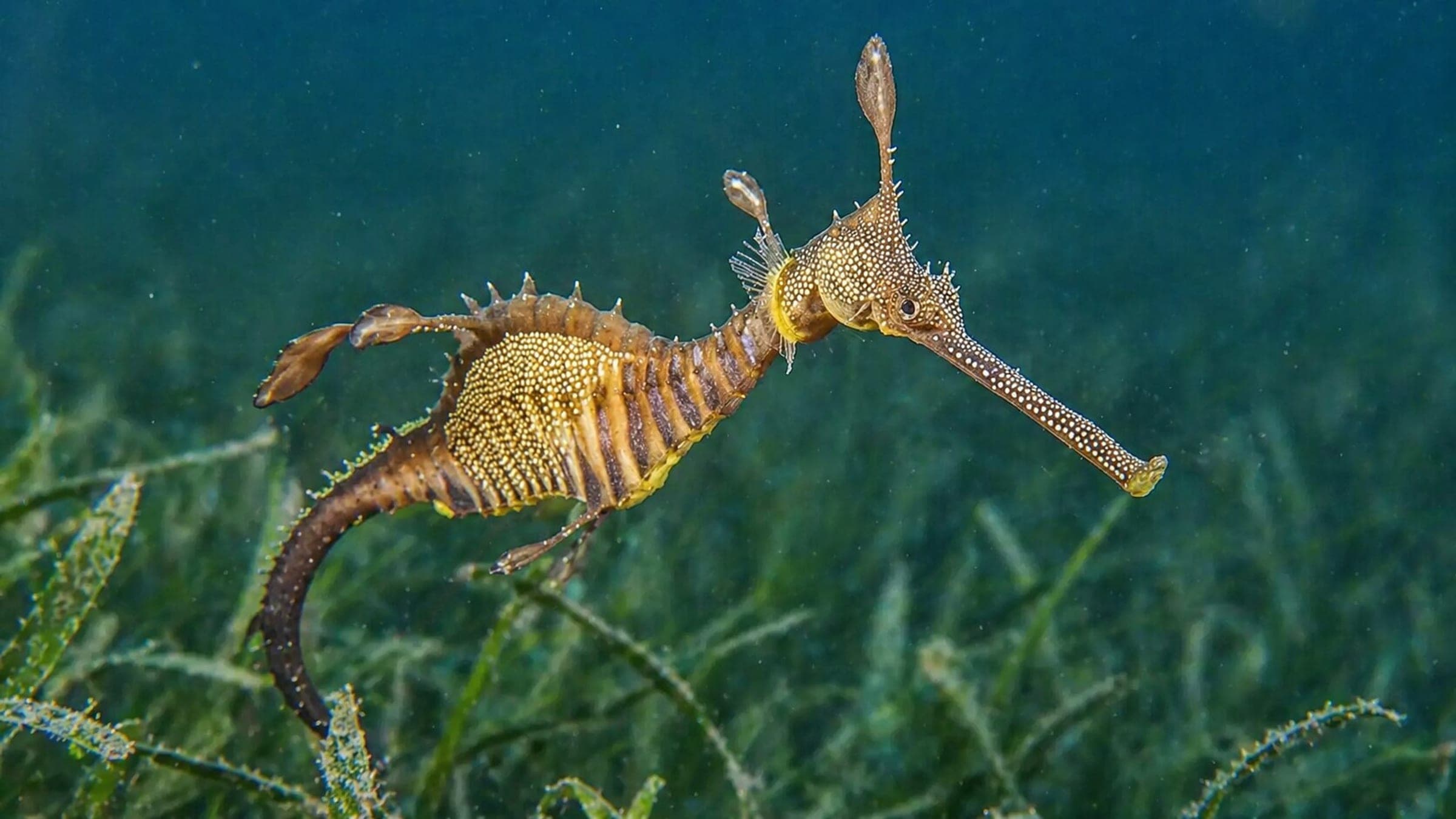
Rye Pier is a shore-access pier dive in Port Phillip Bay with a shallow sandy bottom, pylon life, and a strong night-diving payoff. The long walk out and the pier's wind exposure make it best on calm, high-tide days, but the real draw is slow macro searching for seahorses, octopus, rays, and other small life around the pylons and seagrass.
Conservative baseline from public research. No community dives logged yet.
Depth range, seasonality, and planning context.
Reported Depth
6m
Depth Note
The pier is described at about 6 m maximum depth.
Best Season
Year-round, with winter for spider crabs and the best night dives.
Typical Conditions
Shallow, calm-water pier diving with the best scenery at high tide and the biggest wildlife payoff after dark.
Hazards, restrictions, and access requirements.
Key Hazards
Safety Notes
Watch for blue-ringed octopus, keep buoyancy tight around the pylons, and avoid diving when northerly winds or chop build.
Access Restrictions
Avoid strong northerly winds and plan around tide and public pier activity.
Legal Notes
Follow pier signage and local access rules; fishing and berthing share the area.
Community notes to help plan your visit.
Scuba Diving
Night scuba is especially productive, with macro life clustered around pylons and the sand beside the pier.
Freediving
Not a primary freedive target; the site's best viewing is on scuba, especially after dark.
Snorkeling
Snorkeling is secondary; the real value is the shallow scuba profile around the pier structure.
Species commonly reported at this site, with direct links into their wildlife guides.
Community dive logs and visit reports for this site.
Average conditions based on logged dives & visits.
Planning answers for access, conditions, timing, and site logistics.
Last Updated
Research Sources
Safer access ramp and rebuilt low landing for recreational water users.
Shore access, visibility range, and macro species summary.
Macro focus, night dive appeal, spider crab season, and beginner-friendly framing.
Shallow sandy pier layout, calm high-tide guidance, and common pier life.
Know this site? Improve Spot Details.

Shallow artificial reef north of Rye Pier with easy shore access.
Protected shore dive with macro life, spider crabs, and nudibranchs.
Port Phillip Bay pier dive with rich small life.
Shallow pier dive famous for weedy seadragons
Portsea Hole: advanced boat dive on a steep bay wall
Sheltered boat-access marine sanctuary.