gsdk.dk · Community
Community listing noting that roughly 20m is possible if you swim farther out.
Shore dive in Helsingor with rock, wreck, and training depth.
Shore dive in Helsingor with rock, wreck, and training depth.
Save it, log a dive, or explore nearby on the map.
Save it to come back later
Trykkerdammen is a shore dive in Helsingor with a sloping stone shore, beach or bath-jetty entry, and a rocky route that mixes a small wreck with artificial-reef structure. It is useful for local training and repeat dives when offshore wind and tide cooperate, but the entry, current layers, and boat traffic make it a weather-sensitive site.
Conservative baseline from public research. No community dives logged yet.
Depth range, seasonality, and planning context.
Reported Depth
0m - 20m
Depth Note
Shallow shore entry by beach or stairs; the main route reaches about 10-12 m, and a farther swim can reach around 20 m.
Best Season
Late spring to early autumn
Typical Conditions
Shallow sandy start with eelgrass and seaweed, a wreck and artificial reef farther out, and conditions that swing quickly with wind and tide.
Hazards, restrictions, and access requirements.
Key Hazards
Safety Notes
Watch the shore break, slippery rocks, and layered current; a visible surface buoy matters because ferry and fishing traffic share the area.
Access Restrictions
Best on offshore winds and a calm surface. If waves are up, the beach and staircase entry become much less forgiving.
Legal Notes
Keep clear of ferry lanes, fishing gear, and shoreline users; follow any local harbour or promenade rules.
Community notes to help plan your visit.
Scuba Diving
A good shore-based training site on the calmest days, especially for buoyancy, navigation, and repeat local dives.
Freediving
Possible only as a shallow, carefully managed shore session when the surface is flat; it is primarily a scuba site.
Snorkeling
Snorkeling is marginal and weather-dependent; the useful structure sits farther out, so the site is better as a scuba shore dive.
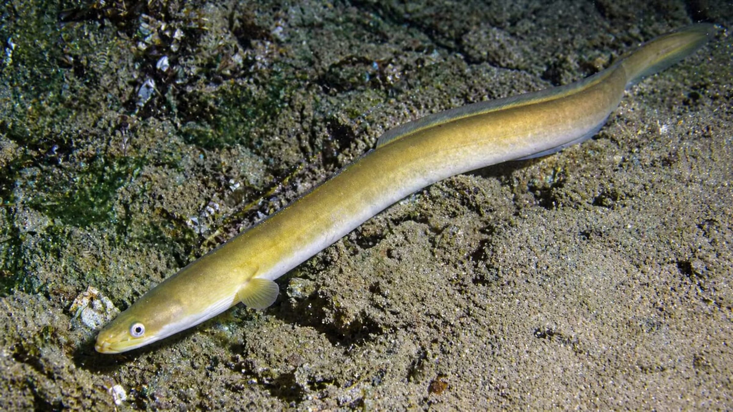
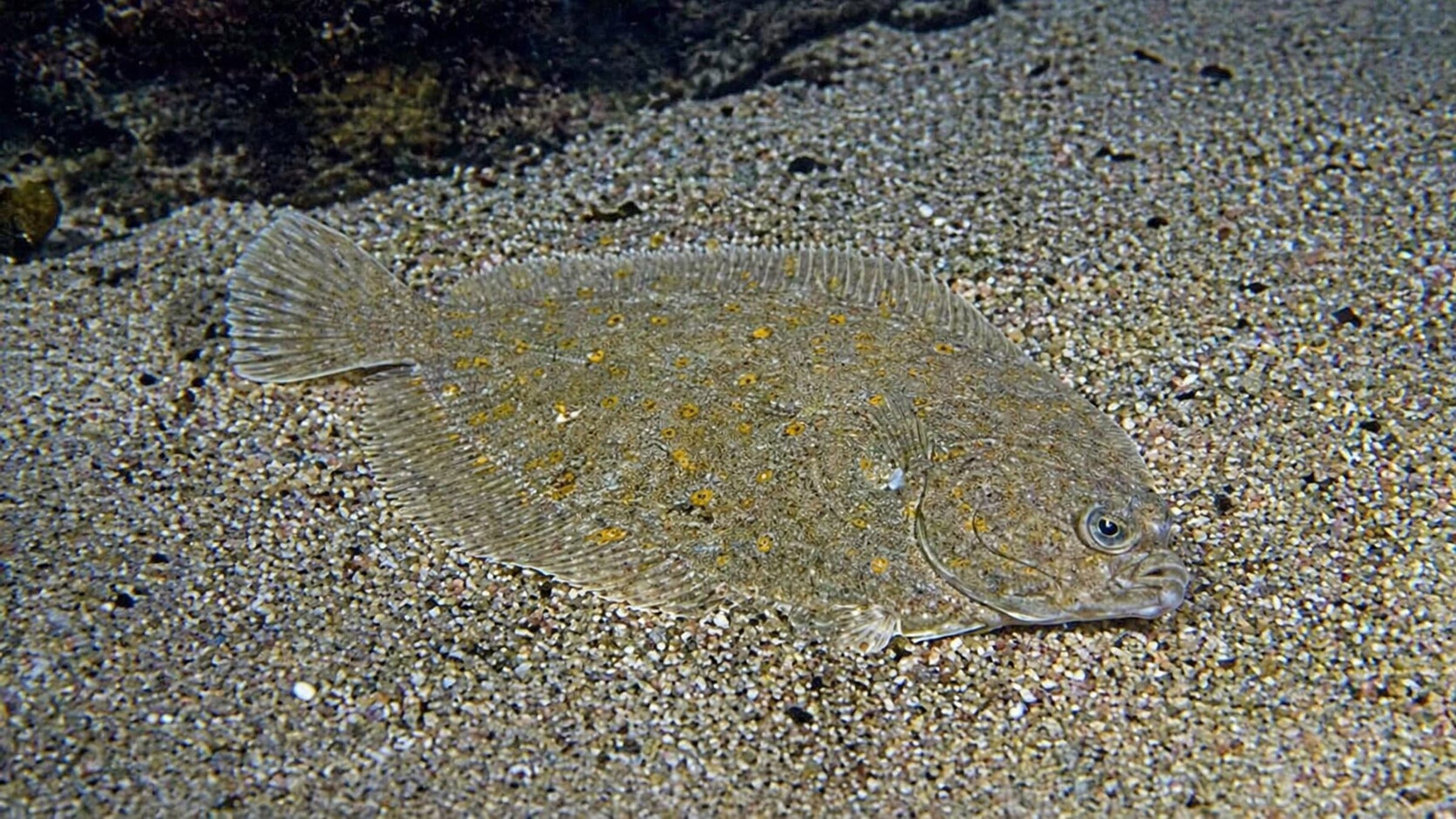
Species commonly reported at this site, with direct links into their wildlife guides.
Community dive logs and visit reports for this site.
Average conditions based on logged dives & visits.
Planning answers for access, conditions, timing, and site logistics.
Last Updated
Research Sources
Community listing noting that roughly 20m is possible if you swim farther out.
Local encyclopedia entry for the historic bay and natural-harbor context.
Operator guide with rocky reef, wreck, beach or stairs entry, current layers, and boat-traffic cautions.
Directory listing with shore entry, 12m site depth, 6-18m visibility range, advanced rating, and eelgrass/flatfish/eel notes.
Official Nordsjalland planning PDF describing the stone beach, outdoor activity use, parking, support areas, and waterfront facilities.
Know this site? Improve Spot Details.

Johannes L: shallow beginner wreck off Råå
Hornbæk Plantage shore reef and kelp dive.
Öresund nature dive around Hven with a deep-to-shallow profile.
Relaxed Kullaberg shore dive near Arild.
Shallow harbor reef with easy access and rich life.
Harbor dive with two entries and a stone reef