tauchzentrale.de · Operator
Operator page with freshwater sponges, visibility, and boat-tour context.
Schmaler Luzin is a lake dive with steep access and sponge-covered timber.
Save it, log a dive, or explore nearby on the map.
Save it to come back later
Reserve access is normally arranged through a dive base, which also handles the permit.
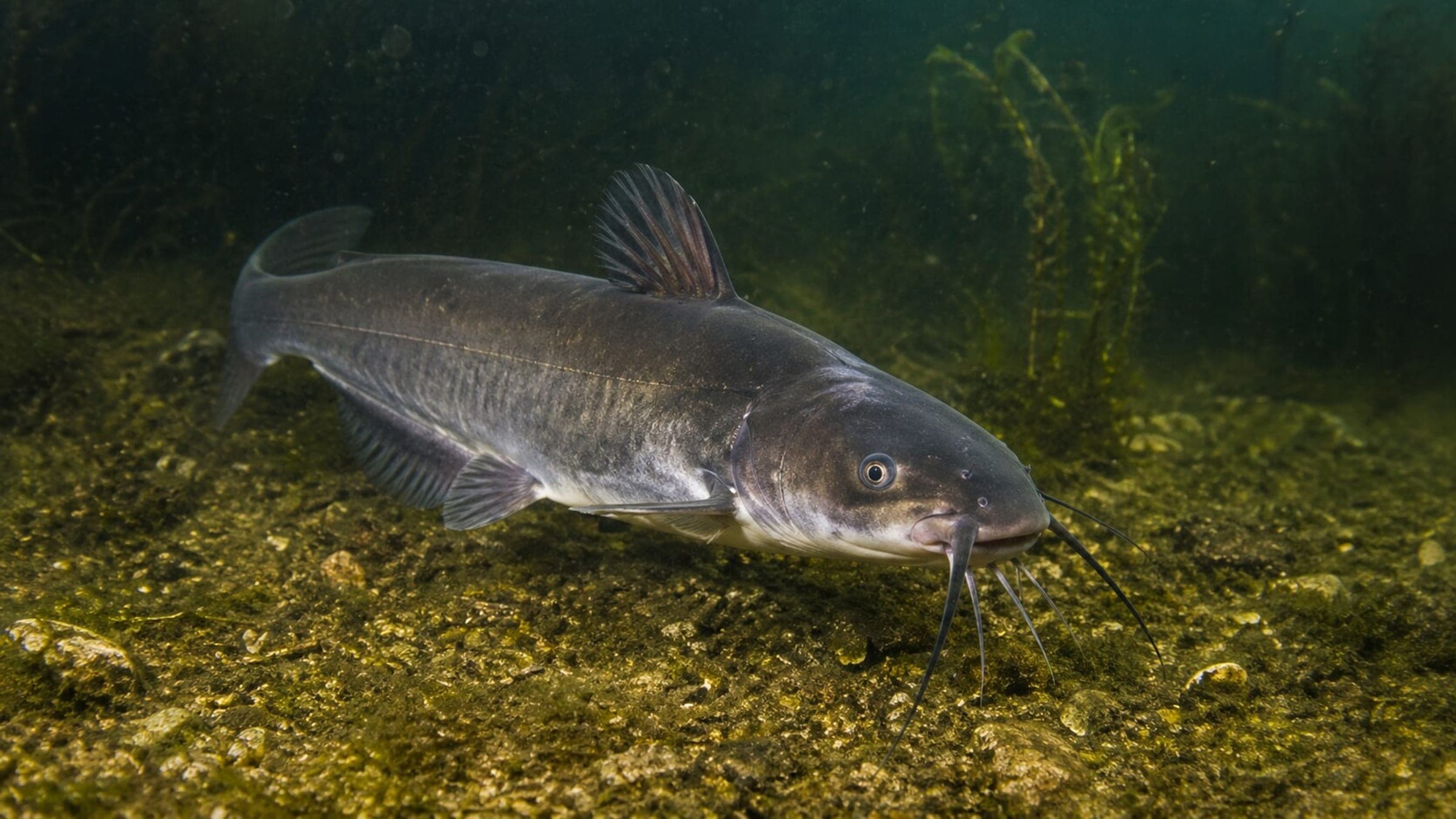
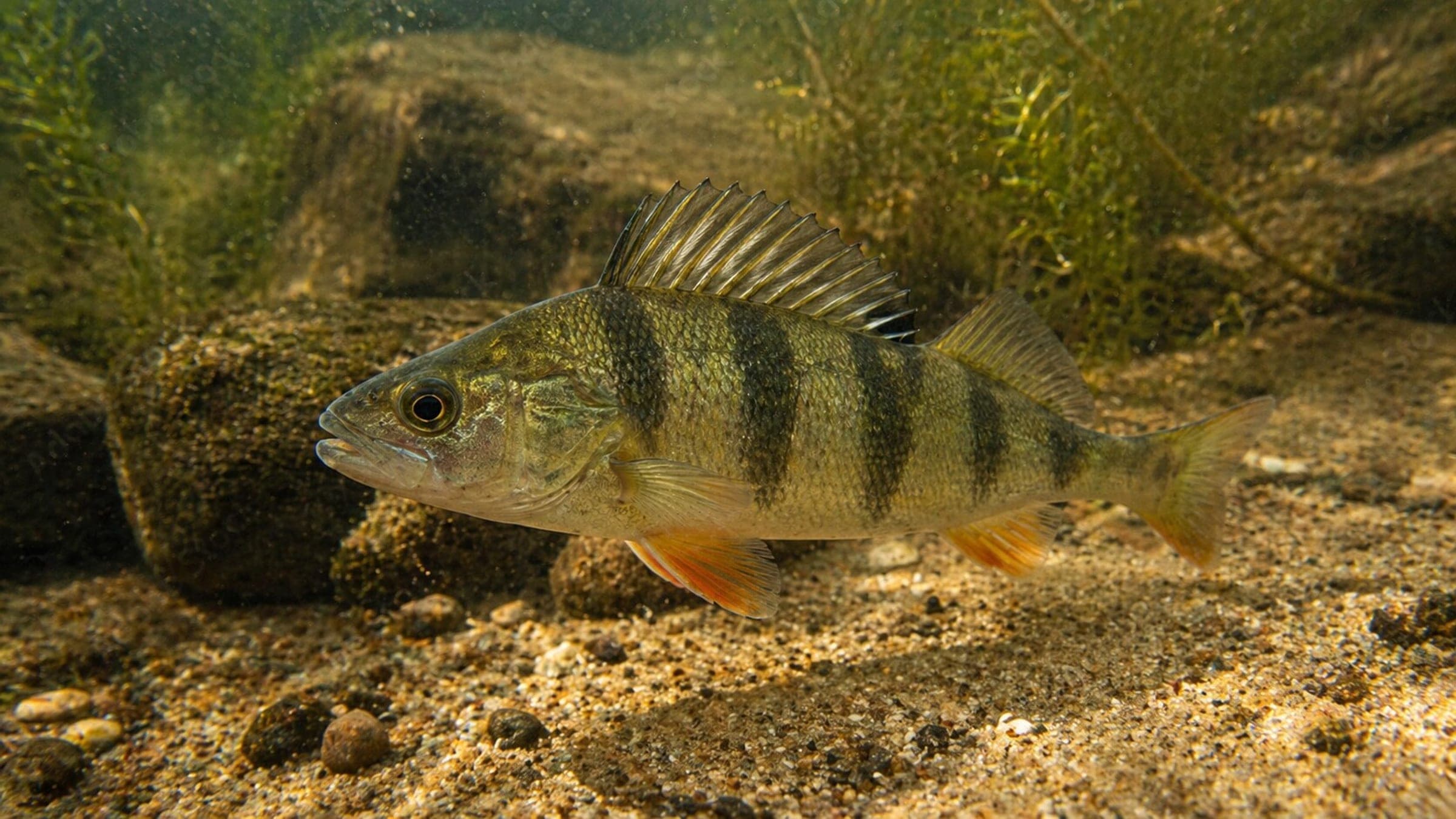
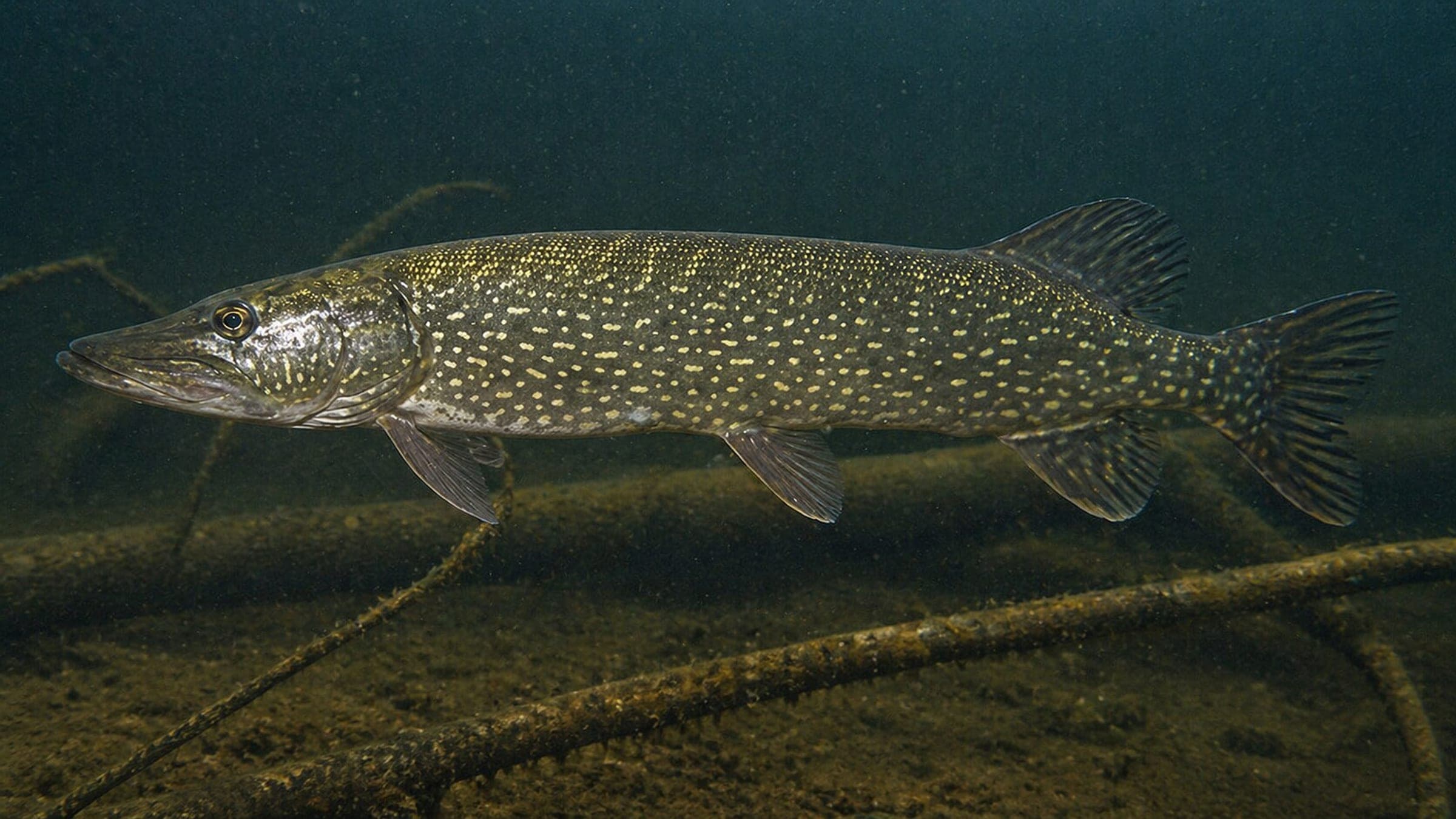
Schmaler Luzin is a narrow freshwater lake dive in the Feldberger Seenlandschaft, with a steep stair approach, submerged trees, and rock piles that create structure close to the bank. Freshwater sponges grow on fallen timber and other hard surfaces, and seasonal fish life can include pike, perch, catfish, and whitefish. Because the site sits inside a reserve, the dive is best approached as a controlled, slow freshwater outing with an organized entry and exit.
Conservative baseline from public research. No community dives logged yet.
Depth range, seasonality, and planning context.
Best Season
Year-round, with summer being the easiest and most comfortable window.
Typical Conditions
Sheltered freshwater lake with steep shore access, modest visibility, and a calm protected feel.
Hazards, restrictions, and access requirements.
Key Hazards
Safety Notes
Plan for the long climb back out and follow the reserve access rules carefully.
Access Restrictions
Nature-reserve permit required; only two official entry points, and night dives or training are not allowed.
Legal Notes
Permits are handled through local dive bases.
Community notes to help plan your visit.
Scuba Diving
Shallow lake structure with fallen trees, rock piles, and sponge-covered wood near the shoreline.
Freediving
The interesting structure sits close to the bank, but the site works better as a slow scuba dive than as a quick breath-hold pass.
Snorkeling
Snorkeling can catch some shoreline structure, but the site is much more rewarding underwater.
Use the planner to scan this week, inspect today in local time, and understand how exposure shapes conditions at Schmaler Luzin.
Directional shelter context for incoming swell.
Species commonly reported at this site, with direct links into their wildlife guides.
Community dive logs and visit reports for this site.
No Dive Logs Yet
Be the first to log a dive at this spot and share your experience!
Average conditions based on logged dives & visits.
Planning answers for access, conditions, timing, and site logistics.
Last Updated
Research Sources
Operator page with freshwater sponges, visibility, and boat-tour context.
Permit rules, official entry points, and shoreline-access context.
Official tourism page with visibility, equipment, and day-boat-tour context.
Know this site? Improve Spot Details.

Steep freshwater shore dive with boulders and cover
Carwitzer Becken is a steep freshwater basin dive with easy shore entry.
Freshwater shore entry at Carwitz on Schmaler Luzin.
Tauchbasis Thomsdorf is a shore training base on Carwitzer See.
Relaxed freshwater lake dive with training platforms and easy access.
A cold freshwater lake dive with torpedo-era wreckage.