www.divers-guide.com · Community
Independent dive-guide page with species and biodiversity notes.
Zeeland shore dive with strong current and tide timing.
Save it, log a dive, or explore nearby on the map.
Save it to come back later
Plompetoren, Koudekerke is a Zeeland shore dive at the edge of the Oosterschelde, named for the remaining tower of the drowned village. The site is a straightforward-to-navigate point with parallel depth lines, oyster banks, sand, and stones, but it is not a lazy dive: strong current, tide timing, and low visibility can all shape the day. It suits divers who are comfortable planning around the tide rather than treating the site like a calm inland reef.
Conservative baseline from public research. No community dives logged yet.
Depth range, seasonality, and planning context.
Reported Depth
0m - 30m
Depth Note
Depth lines run approximately parallel to the shore and continue down to about 30m.
Best Season
Year-round, with the best windows on settled tide days.
Typical Conditions
Oyster banks, sand, and stones with a straight profile that becomes current-sensitive when the tide turns.
Hazards, restrictions, and access requirements.
Key Hazards
Safety Notes
Plan the dive around the tide and keep the route simple on the way back. Current and visibility are the main variables here.
Access Restrictions
Best dived at high water; missing the tide window can make conditions poor.
Legal Notes
Follow local Oosterschelde access guidance and the usual Zeeland dive-site rules.
Community notes to help plan your visit.
Freediving
Not a freedive target; the current and depth lines make this a scuba site.
Snorkeling
The useful structure sits beyond casual surface viewing and the current can be too much for a relaxed snorkel.
Use the planner to scan this week, inspect today in local time, and understand how exposure shapes conditions at Koh Rang Ban That / เกาะรางบรรทัด.
Directional shelter context for incoming swell.
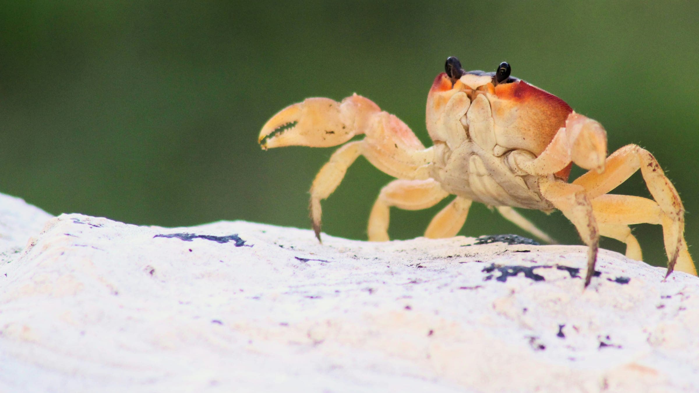
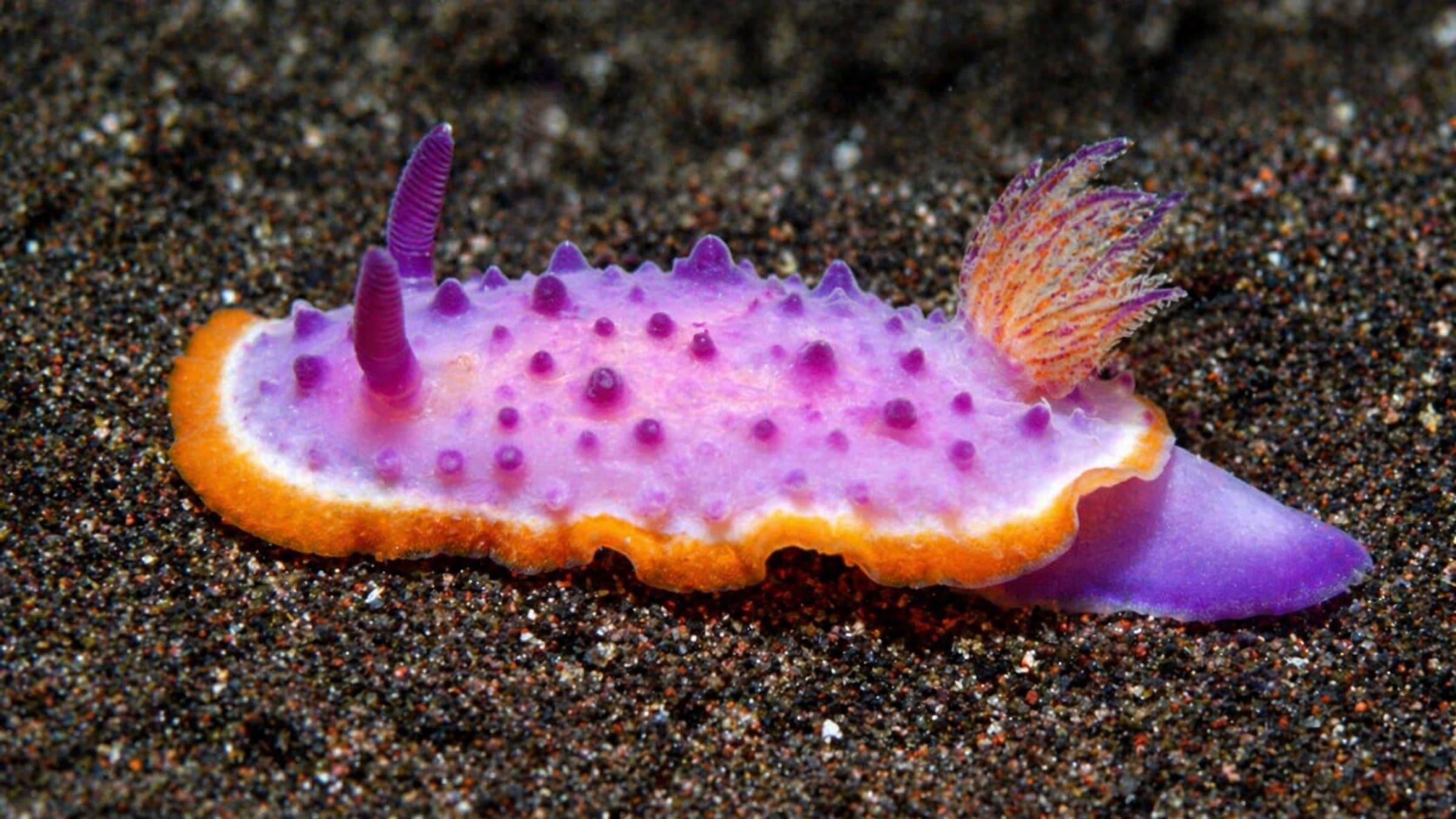
Species commonly reported at this site, with direct links into their wildlife guides.
Community dive logs and visit reports for this site.
No Dive Logs Yet
Be the first to log a dive at this spot and share your experience!
Average conditions based on logged dives & visits.
Planning answers for access, conditions, timing, and site logistics.
Last Updated
Research Sources
Independent dive-guide page with species and biodiversity notes.
Local dive-trip page with strong current and visibility notes.
Official Zeeland dive-location page naming the site and its drowned-village origin.
Know this site? Improve Spot Details.

Controlled boat dive by a restricted Chumphon island.
Very shallow island stop near the Tong Tom dive center.
Sheltered Tong Tom Yai bay used for boat launches and clear-water dives.
Nearshore Mud Wai island with rich reef life.
Community-built artificial habitat site in sheltered Tong Tom Bay.
Quiet Chumphon shore bay for shallow snorkeling and easy fish spotting.