lajeviva.org.br · Official
Reserve and ecotourism program source.
Exposed boulder sector on the Laje reserve.
The site is inside a protected offshore reserve and is normally dived only on licensed operator trips.
Calhaus is a deeper rock-and-boulder sector on the Laje de Santos reserve where large stone blocks, schooling fish and blue-water spacing make it feel more exposed than the island’s pocket dives.
Conservative baseline from public research. No community dives logged yet.
Depth range, seasonality, and planning context.
Reported Depth
8m - 40m
Depth Note
Route depth depends on whether the dive stays on the tunnel, north face, or more exposed south face; the tunnel section is shallower and the south face is the deepest line.
Best Season
Winter into spring is typically favored for clearer water on Laje de Santos, though any trip still depends on offshore sea state.
Typical Conditions
Expect an offshore run from the Santos coast, open-water surroundings and conditions that change quickly with swell, current and visibility.
Hazards, restrictions, and access requirements.
Key Hazards
Safety Notes
Sea conditions can prevent diving here. With no anchoring ropes and a moving-boat giant stride entry, good boat-handling and diver control are important. The tunnel section adds an overhead component.
Access Restrictions
Boat access only inside Laje de Santos Marine State Park. Operators usually hold Calhaus for days with calm enough swell and sea state to run the tunnel or wall line safely.
Legal Notes
Calhaus sits inside Parque Estadual Marinho da Laje de Santos, where access is by authorized operators and mooring / reserve rules apply.
Community notes to help plan your visit.
Scuba Diving
Best as a blue-water scuba route around boulders and rock faces, with the group staying compact if current or visibility tighten up.
Freediving
Not a routine freedive stop because the site is visited on scuba charters and the exposed offshore setting leaves little margin for unsupported drops.
Snorkeling
Not a practical snorkel option for most visitors because Calhaus is an offshore boat dive with conditions that can shift well before surface swimmers get value.
Use the planner to scan this week, inspect today in local time, and understand how exposure shapes conditions at Calhaus.
Directional shelter context for incoming swell.
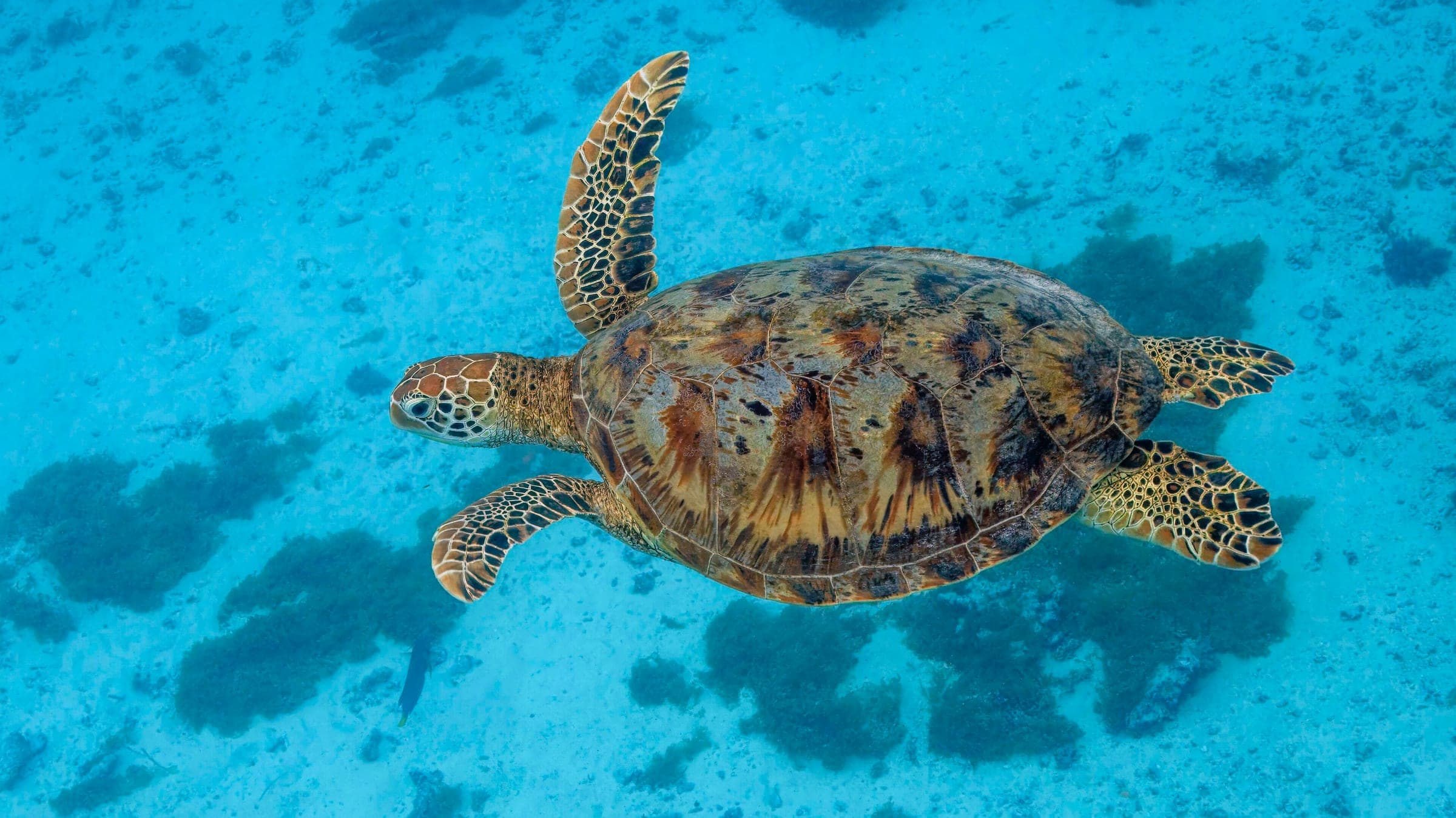
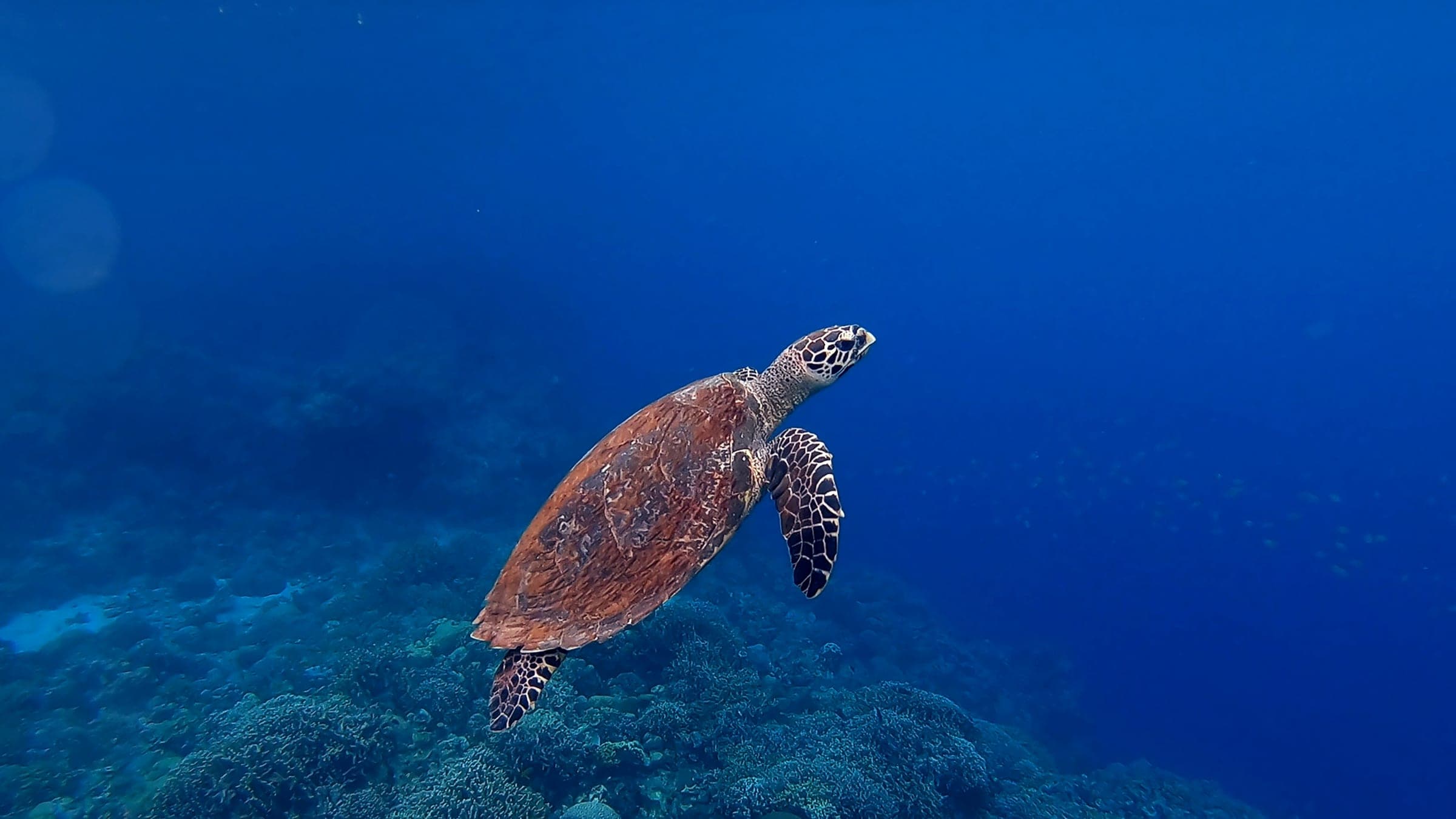
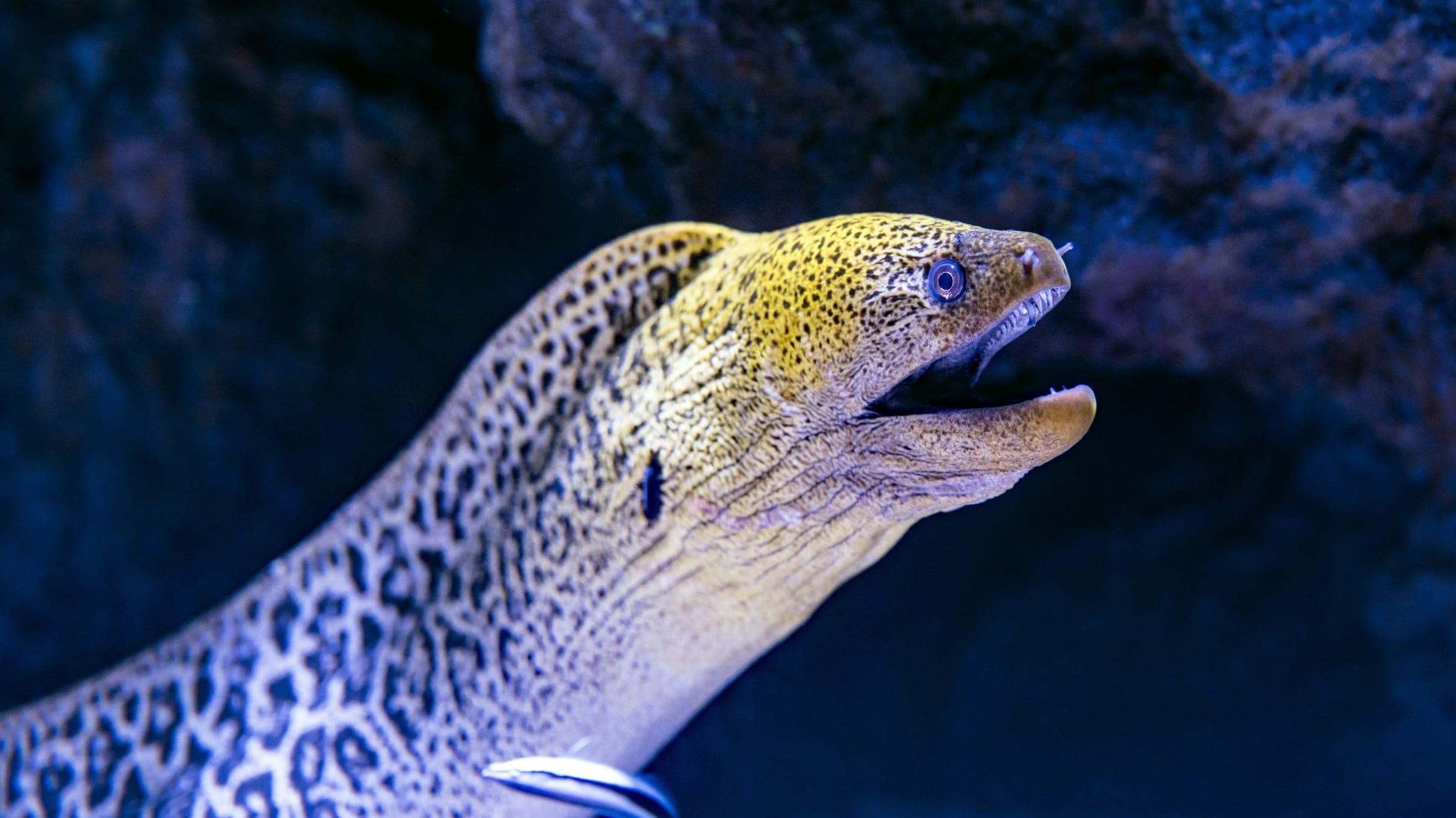
Species commonly reported at this site, with direct links into their wildlife guides.
Community dive logs and visit reports for this site.
No Dive Logs Yet
Be the first to log a dive at this spot and share your experience!
Average conditions based on logged dives & visits.
Planning answers for access, conditions, timing, and site logistics.
Last Updated
Research Sources
Reserve and ecotourism program source.
Public operator material on Laje dive sectors and conditions.
Public spot-specific cross-check.
Know this site? Improve Spot Details.

Whale-shaped rock route with turtles and rays.
Sheltered pocket dive with frequent turtle sightings.
Pool-like reserve route with clear water and fish life.
Historic mooring-sector dive on the Laje reserve.