www.gralon.net · Community
Open-access natural site listing with scuba and freedive activities.
Sheltered rocky dive at Cristaou with easy access.
Save it, log a dive, or explore nearby on the map.
Save it to come back later
Cap Benat is a sheltered Mediterranean dive area at the southern end of Bormes, centered on the Cristaou islet and the series of small creeks that follow it. It is an easy, open-access rocky dive with crevices, holes, and cracks, making it a good fit for relaxed exploration and photo work when the western side of the bay is protected from wind and chop. The site rewards careful buoyancy more than depth chasing.
Conservative baseline from public research. No community dives logged yet.
Depth range, seasonality, and planning context.
Reported Depth
8m - 27m
Depth Note
The site is listed from about 8 to 27 m and is centered on the sheltered Cristaou / Cap Bénat rocky profile.
Best Season
Year-round, especially when westerly winds are up.
Typical Conditions
Sheltered rocky site that stays protected in strong westerly winds, with small creeks, crevices, holes, and cracks.
Hazards, restrictions, and access requirements.
Key Hazards
Safety Notes
Watch buoyancy in the creeks and crevices; sheltered conditions can still mean tight rocky structure.
Access Restrictions
Open-access site around Cristaou; best approached on sheltered days and with local guidance if you route toward nearby protected areas.
Legal Notes
This is a natural open-access site in the Cap Bénat area; follow park rules if you extend dives toward nearby marine reserves.
Community notes to help plan your visit.
Scuba Diving
A relaxed Mediterranean dive with small creeks and easy terrain, good for buoyancy practice and photo work.
Freediving
A good freedive training ground in calm conditions thanks to its easy profile and open access.
Snorkeling
The sheltered shallows can work for snorkeling when the bay is calm, though the more interesting structure is below the surface.
Use the planner to scan this week, inspect today in local time, and understand how exposure shapes conditions at Cap Benat.
Directional shelter context for incoming swell.
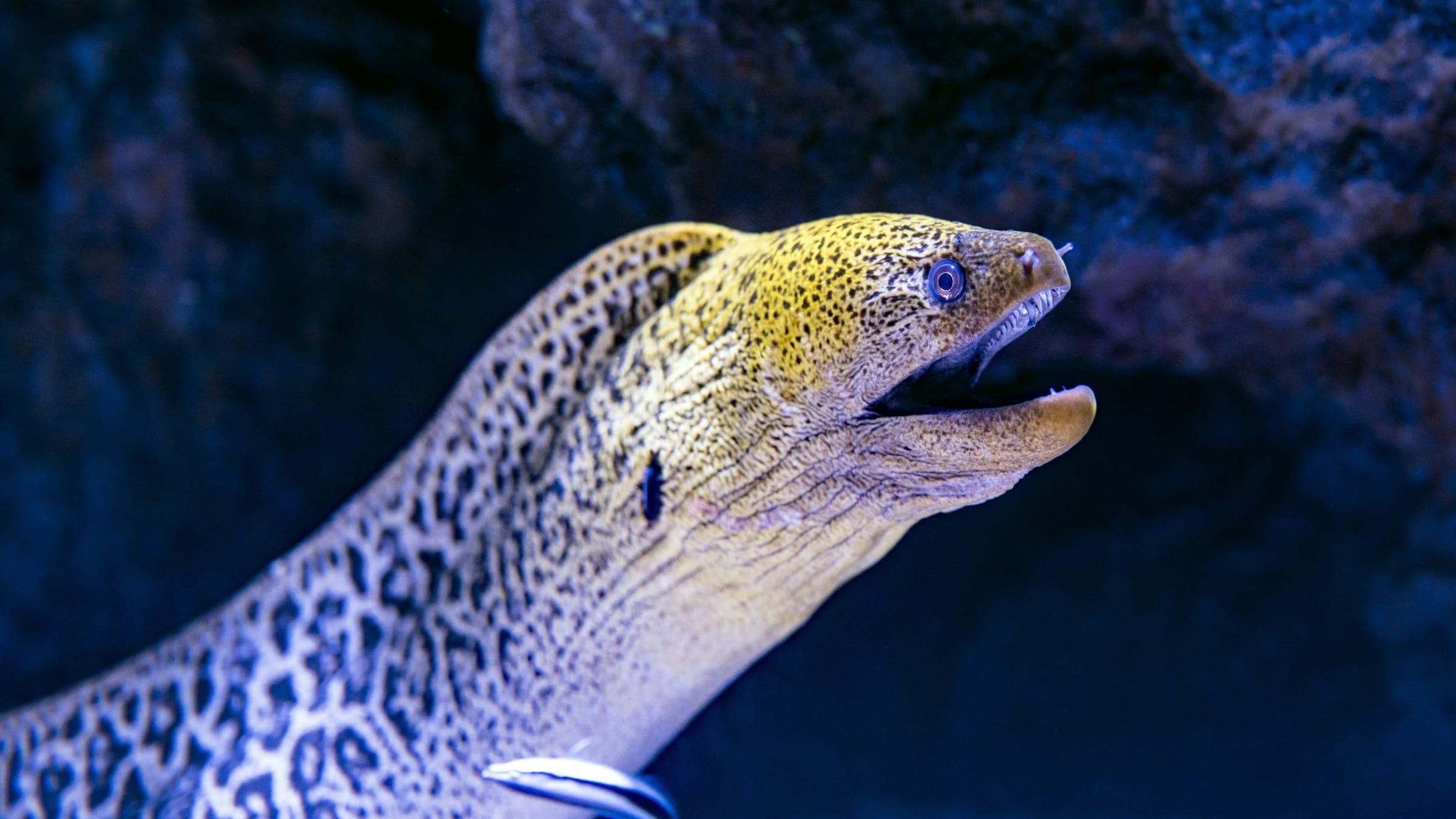
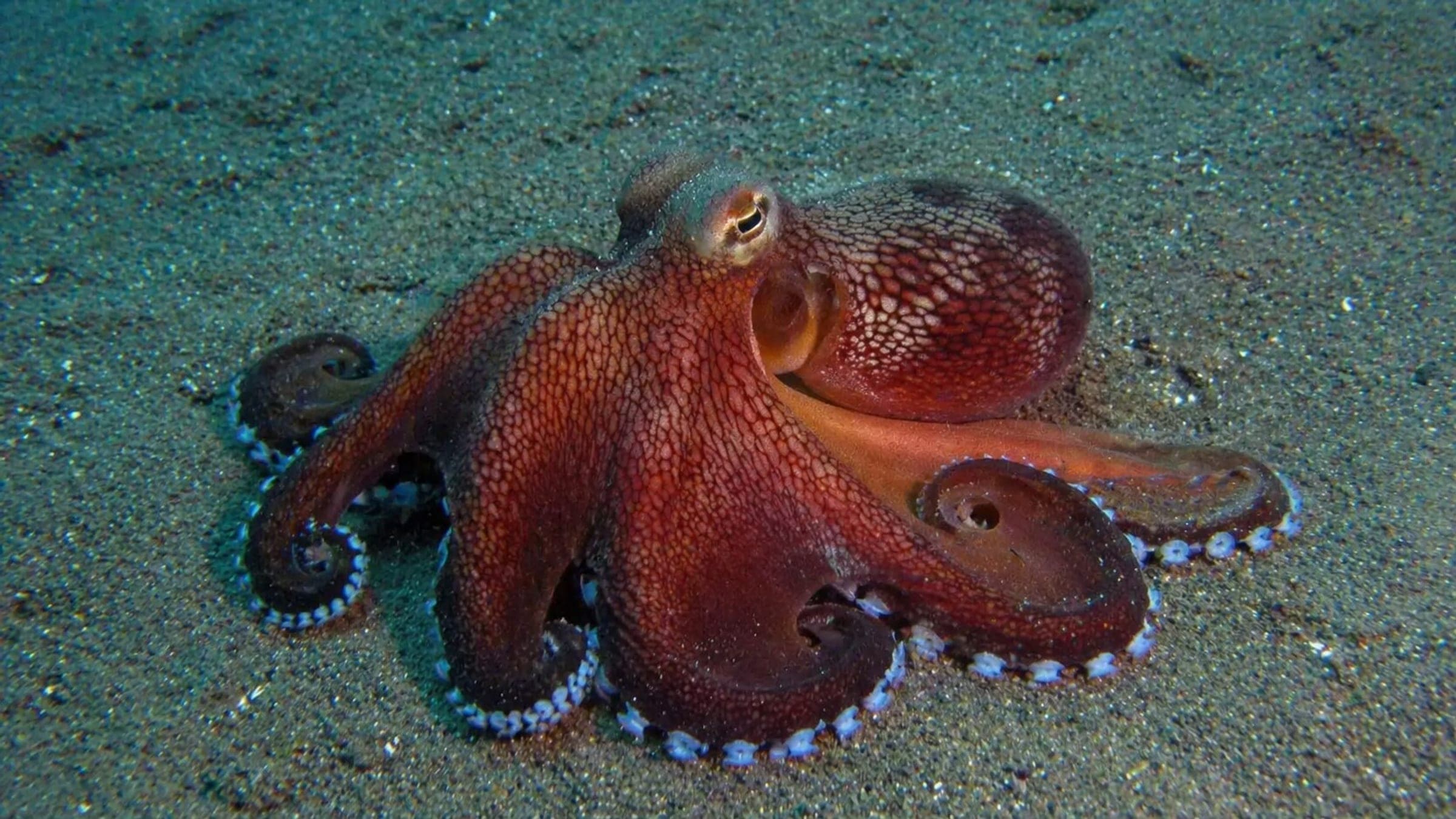
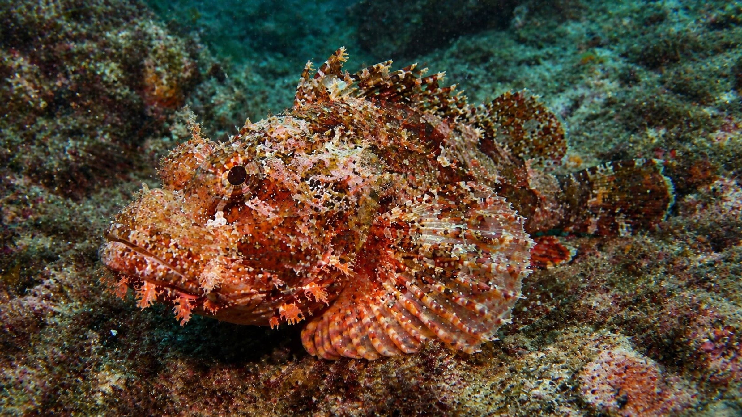
Species commonly reported at this site, with direct links into their wildlife guides.
Community dive logs and visit reports for this site.
No Dive Logs Yet
Be the first to log a dive at this spot and share your experience!
Average conditions based on logged dives & visits.
Planning answers for access, conditions, timing, and site logistics.
Last Updated
Research Sources
Open-access natural site listing with scuba and freedive activities.
Operator context for sheltered bay dives around Cap Benat.
Directory entry with depth range and dive-type labels.
Operator page describing Cristaou as easy and accessible for all levels.
Know this site? Improve Spot Details.

Deep boat wreck with a dramatic upside-down aircraft silhouette.
Advanced boat dive with a steep sandy slope and strong current.
La Gabinière la Calanque Sombre is a boat drop-off with steep east-side relief.
Deep wall dive between Porquerolles and Port-Cros.
Sec du Gendarme, Porquerolles with sponges, gorgonians, and current
Cap des Mèdes is a sheltered Porquerolles introduction dive.