colombia.travel · Tourism
Official tourism page placing Punta Betin at the north end of Santa Marta and describing the headland.
Port-side Santa Marta wreck-and-wall dive with soft coral and fish life.
The port-side setting and boat logistics make a local dive center the practical way to run the site.
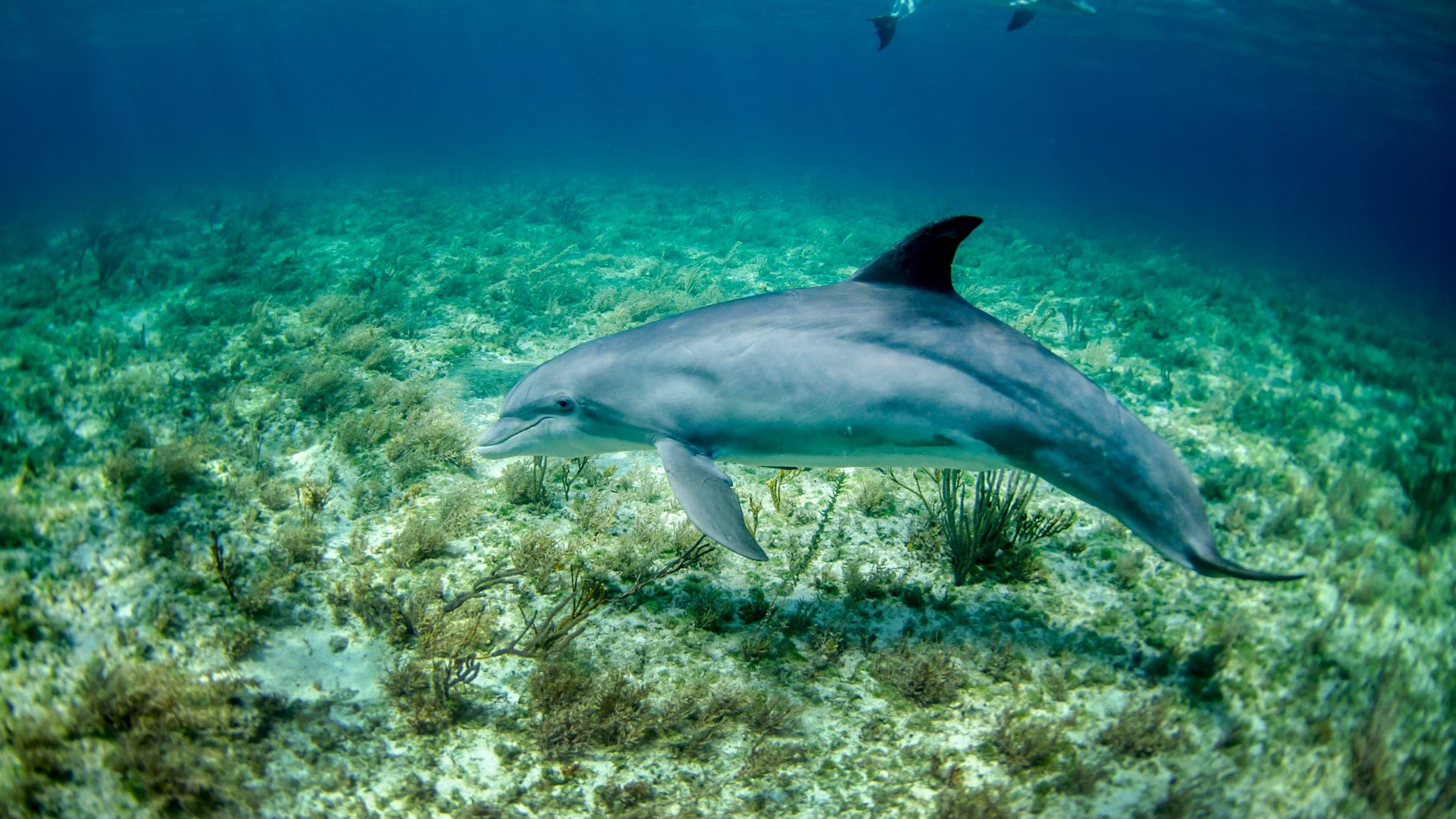
Punta Betin is a Santa Marta boat dive with wreck material, a soft-coral reef and wall, and a port-side setting that rewards slow, controlled exploration of the structure.
Conservative baseline from public research. No community dives logged yet.
Depth range, seasonality, and planning context.
Reported Depth
Up to 18m
Depth Note
The public site listing caps the dive at about 18m and frames it as a wreck-and-wall site in the Santa Marta port zone.
Best Season
Late fall through spring, when Santa Marta conditions are usually calmer and clearer.
Typical Conditions
Boat dive with wreck material, a soft-coral wall, and a port-influenced coastal setting where visibility can change quickly.
Hazards, restrictions, and access requirements.
Key Hazards
Safety Notes
Plan the dive as a guided boat site, keep a good eye on your buoyancy around wreck material, and be conservative if visibility drops.
Access Restrictions
Boat access is the practical default, and conditions in the port zone can affect whether the site is worth diving on a given day.
Legal Notes
The site sits in the Santa Marta port/coastal zone, so normal port, boat, and local dive-operator rules apply.
Community notes to help plan your visit.
Scuba Diving
Best as a guided boat dive with a buoy and light. The wreck and wall structure reward slow, controlled exploration.
Freediving
Not a primary freedive site. The wreck-and-wall profile makes scuba the better fit for most visits.
Snorkeling
Snorkeling is secondary here; the useful structure sits below the surface on the wreck and wall line.
Use the planner to scan this week, inspect today in local time, and understand how exposure shapes conditions at Punta Betin.
Directional shelter context for incoming swell.
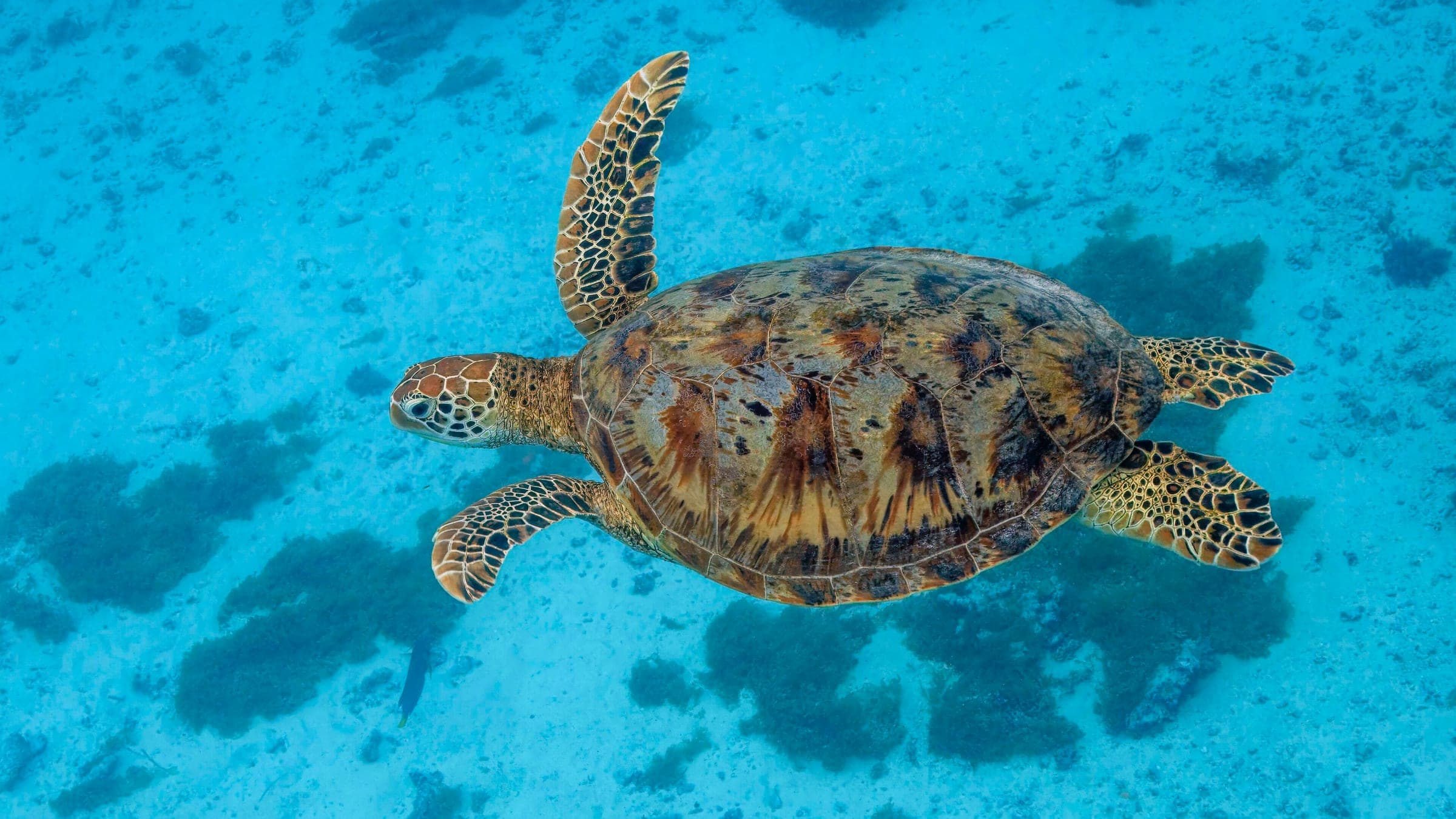
Species commonly reported at this site, with direct links into their wildlife guides.
Community dive logs and visit reports for this site.
No Dive Logs Yet
Be the first to log a dive at this spot and share your experience!
Average conditions based on logged dives & visits.
Planning answers for access, conditions, timing, and site logistics.
Last Updated
Research Sources
Official tourism page placing Punta Betin at the north end of Santa Marta and describing the headland.
Regional directory describing the rock mass and its position on the Santa Marta peninsula.
Know this site? Improve Spot Details.

El Morro: Santa Marta reef terrace by boat
Boat-access reef with clear water and reef life.
Calm shallow reef at Playa Inca Inca in Santa Marta.
Protected bay dive in Tayrona National Park.
Nearshore reef around Santa Marta's islet
El Nataly: Santa Marta wreck for lionfish