www.furesoe.dk · Official
Municipal bathing-area page for the lake system and seasonal water-quality oversight.
Shore-entry freshwater lake dive with weeds, pike, and navigation practice.
Shore-entry freshwater lake dive with weeds, pike, and navigation practice.
Save it, log a dive, or explore nearby on the map.
Save it to come back later
A local club or operator is the practical way to handle booking, permission, and site timing.
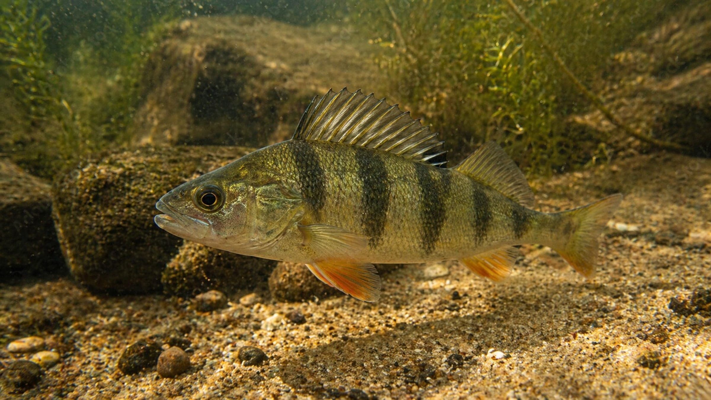
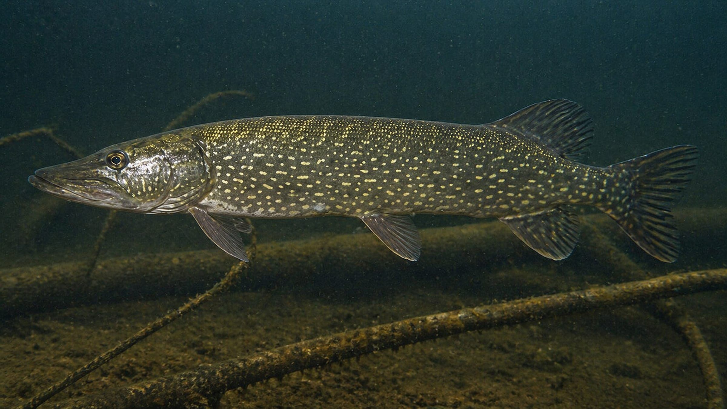
Furesø is a shallow freshwater lake dive in Denmark's deepest lake, built around weed beds, mussel banks, and a deeper edge rather than coral structure. It is a shore-entry route from Furesøbad where you work from the beach or bathing jetty and keep a close eye on your bearings. The site is a good fit for buoyancy and navigation practice in water that can go murky quickly. Crayfish and fish hold on the deeper side, while the shallow shelves are the easiest part of the dive.
Conservative baseline from public research. No community dives logged yet.
Depth range, seasonality, and planning context.
Reported Depth
2m - 12m
Depth Note
The dive starts around 2-5m and the deeper edge runs to about 12m.
Best Season
Late spring to early autumn
Typical Conditions
Freshwater shore diving with weed beds, mussel banks, and visibility that can make navigation more important than depth.
Hazards, restrictions, and access requirements.
Key Hazards
Safety Notes
Carry a surface marker buoy, use shoreline fixpoints and a compass, and do not ignore the mild current when you set up the return.
Access Restrictions
Booking is required, and you should use the marked landing sites with the Nature Agency permission in place.
Community notes to help plan your visit.
Scuba Diving
A shore dive with a shallow route and a slightly deeper fish-holding edge. The best plan is to keep the group tight, work the compass line, and use the shoreline as your anchor if visibility drops.
Species commonly reported at this site, with direct links into their wildlife guides.
Community dive logs and visit reports for this site.
Average conditions based on logged dives & visits.
Planning answers for access, conditions, timing, and site logistics.
Last Updated
Research Sources
Municipal bathing-area page for the lake system and seasonal water-quality oversight.
Local drive-and-dive guidance with access, parking, current, and navigation advice.
Official Naturstyrelsen access page for the Furesø recreational area and booking rules.
Know this site? Improve Spot Details.

Shallow harbor reef with easy access and rich life.
Harbor dive with two entries and a stone reef
Artificial wreck with a shore walk and exit openings
Sundby Bad is a Copenhagen indoor pool used by dive clubs for training.
Havheksen is a shallow Copenhagen training reef with easy shore access.
Hornbæk Plantage shore reef and kelp dive.