es.wikipedia.org · Community Reference
Supplemental condition context for crowding and currents.
Sheltered beach-entry training bay in Puerto de Mazarrón
Save it, log a dive, or explore nearby on the map.
Save it to come back later
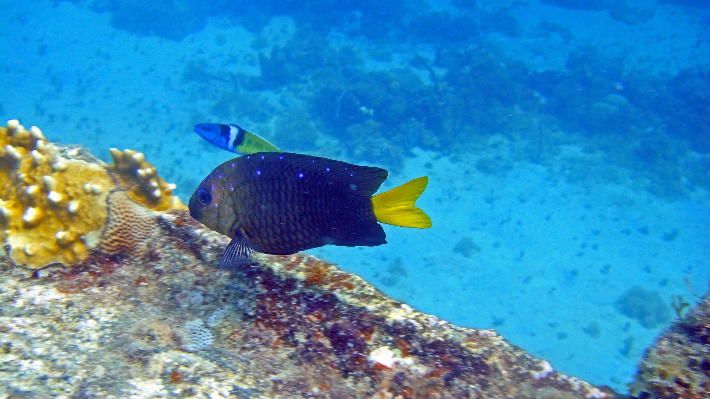
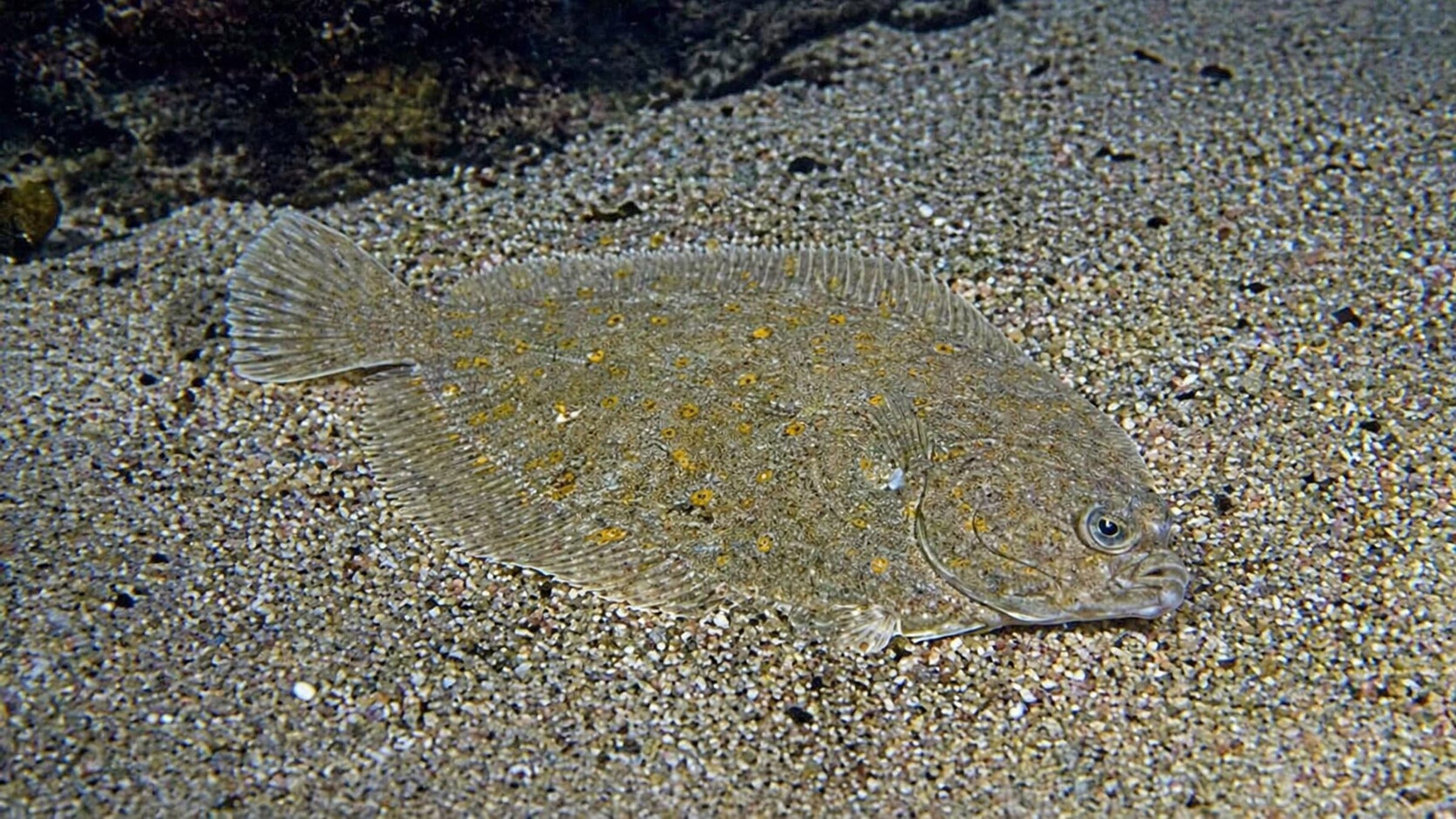
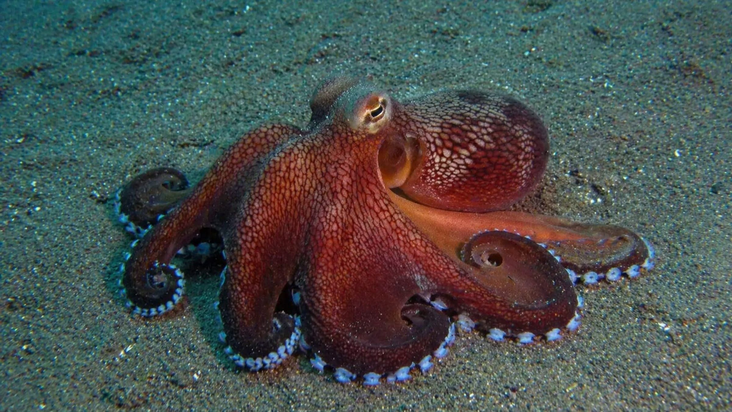
Playa de Bahía is a sheltered beach-entry dive in Puerto de Mazarrón, used for beginner training and easy check-out dives. The seabed is mostly sand with scattered rocky patches around a small bay, so the route stays simple and easy to orient from shore. Typical sightings include damselfish, flatfish, starfish and octopus. It works best on calm days when you want a low-friction shore dive or snorkel loop.
Conservative baseline from public research. No community dives logged yet.
Depth range, seasonality, and planning context.
Depth Note
Shallow beach-entry basin with sandy floor and rocky edges around the bay.
Best Season
Late spring through early autumn
Typical Conditions
Usually low-wave and straightforward for a shore session; the open side of the bay can feel less settled when wind picks up.
Hazards, restrictions, and access requirements.
Key Hazards
Safety Notes
Best treated as a calm-day shore dive. Keep an eye on the open side of the bay if wind or swell rises.
Legal Notes
Playa de Bahía is designated as a smoke-free beach.
Community notes to help plan your visit.
Scuba Diving
Used for initiation courses and other training activities.
Snorkeling
A short snorkel loop works from the beach, especially by heading left toward Cabezo de la Reya and returning along the bay edge.
Use the planner to scan this week, inspect today in local time, and understand how exposure shapes conditions at Playa de Bahía.
Directional shelter context for incoming swell.
Species commonly reported at this site, with direct links into their wildlife guides.
Community dive logs and visit reports for this site.
No Dive Logs Yet
Be the first to log a dive at this spot and share your experience!
Average conditions based on logged dives & visits.
Planning answers for access, conditions, timing, and site logistics.
Last Updated
Research Sources
Supplemental condition context for crowding and currents.
Regional tourism material that labels Playa de Bahía as smoke-free and urban.
Operator page for the Mazarrón area; includes visibility, species, and dive-support context.
Local snorkel route notes from Playa de Bahía toward Cabezo de la Reya.
Regional tourism listing with urban-road access and bus stop context.
Beach-services page with low-wave, accessible-beach and facility details.
Know this site? Improve Spot Details.

Shallow island dive off Playa de la Isla
Cala del Faro: quiet beginner cove in Mazarrón
Current-driven seamount dive with big Mediterranean life.
Murcia Cabo de Palos and Islas Hormigas: shore dive
Boat-access pinnacle with caves and overhangs.