www.divespots.com · Dive Directory
Depth range and LSM placement within the reef system.
LSM Barge 1 is a boat-access wreck reef with strong Gulf fish life.
Save it, log a dive, or explore nearby on the map.
Save it to come back later
This is a boat-access artificial reef built around a WWII-era Navy Landing Ship Module off Indian Shores. The wreck is known locally as LSM 1 or the Cable Wreck and sits within a structured reef system made of wreck pieces, cable, and reef material. Divers come for the structure, the mixed relief, and the larger Gulf fish that move through it. Expect a straightforward wreck-and-reef profile with weather-shaped visibility and occasional current changes.
Conservative baseline from public research. No community dives logged yet.
Depth range, seasonality, and planning context.
Reported Depth
12m - 14m
Depth Note
Indian Shores Reef is reported at about 40-46 ft of water. The LSMs were sunk there in roughly 45 ft, while the 235' figure describes the wreck module itself rather than the site depth.
Best Season
Late spring and early fall usually offer the best visibility; winter and early spring can be less predictable.
Typical Conditions
Boat-access wreck-and-reef dive with moderate depth, variable Gulf visibility, and weather-driven changes in current.
Hazards, restrictions, and access requirements.
Key Hazards
Safety Notes
Cable-filled wreck sections can snag gear, so stay streamlined and keep the dive inside your training, gas plan, and buoyancy control.
Access Restrictions
Boat access only; plan the dive with a local charter familiar with the Indian Shores reef system.
Legal Notes
Follow local reef rules and charter guidance; do not anchor on the wreck or remove artifacts or marine life.
Community notes to help plan your visit.
Scuba Diving
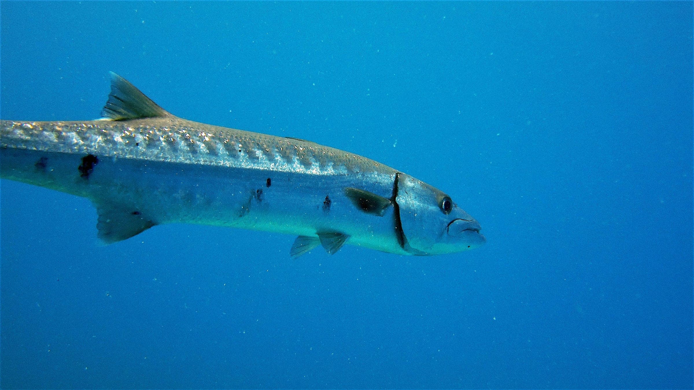
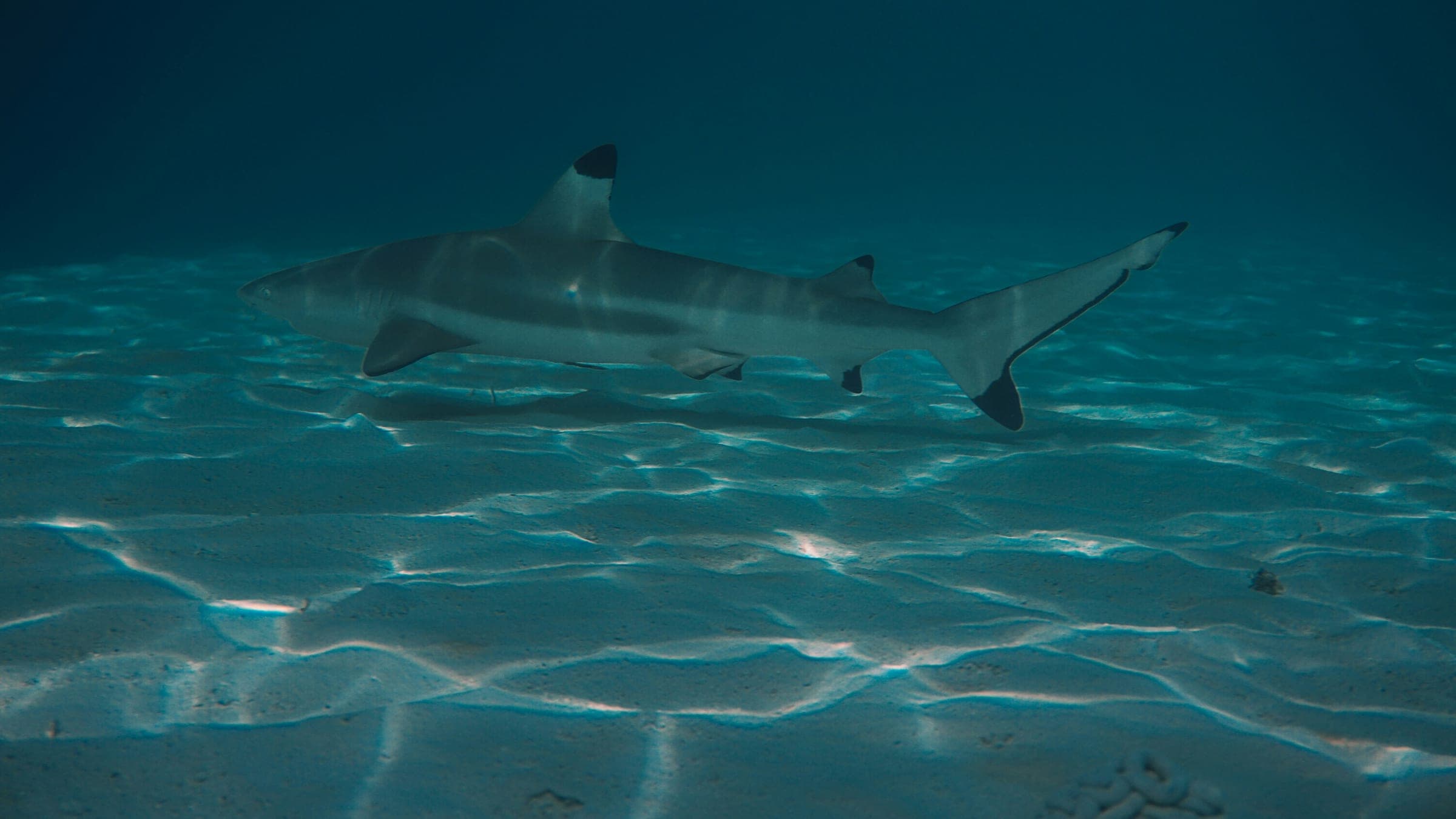
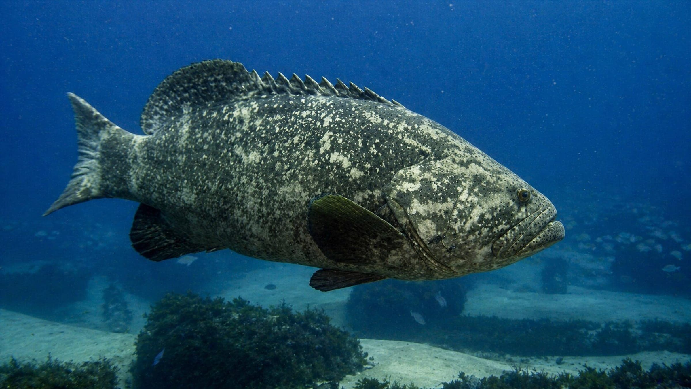
Wreck dive on an artificial reef structure with chances of seeing larger fish and sharks.
Freediving
Not a freedive-first site; the wreck profile and boat access make scuba the practical choice.
Snorkeling
Not a practical snorkel site; the main structure sits below comfortable snorkel range.
Use the planner to scan this week, inspect today in local time, and understand how exposure shapes conditions at LSM Barge 1.
Directional shelter context for incoming swell.
Species commonly reported at this site, with direct links into their wildlife guides.
Community dive logs and visit reports for this site.
No Dive Logs Yet
Be the first to log a dive at this spot and share your experience!
Average conditions based on logged dives & visits.
Planning answers for access, conditions, timing, and site logistics.
Last Updated
Research Sources
Depth range and LSM placement within the reef system.
Advanced Open Water label, cable-filled wreck structure, and larger fish notes.
GPS and alternate-name confirmation.
Official Indian Shores Reef overview and southern-end LSM placement.
Know this site? Improve Spot Details.

Shallow memorial dive with statue reef and boat access.
Rube Allyn Reef is an offshore artificial reef off Clearwater.
Boat-accessible artificial-reef tug with classic Gulf fish life.
Offshore Gulf ledge dive with grouper, turtles, and variable visibility.
Sheridan (Wreck) is a popular Clearwater tug wreck.
Betty Rose is a shallow wreck off St. Petersburg.