puertovallartatours.net · Operator
Tour page used for snorkel suitability, calm-water routing, and broad skill-level guidance.
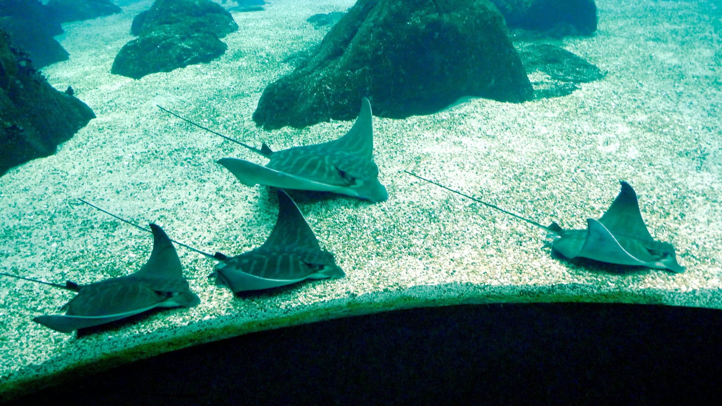
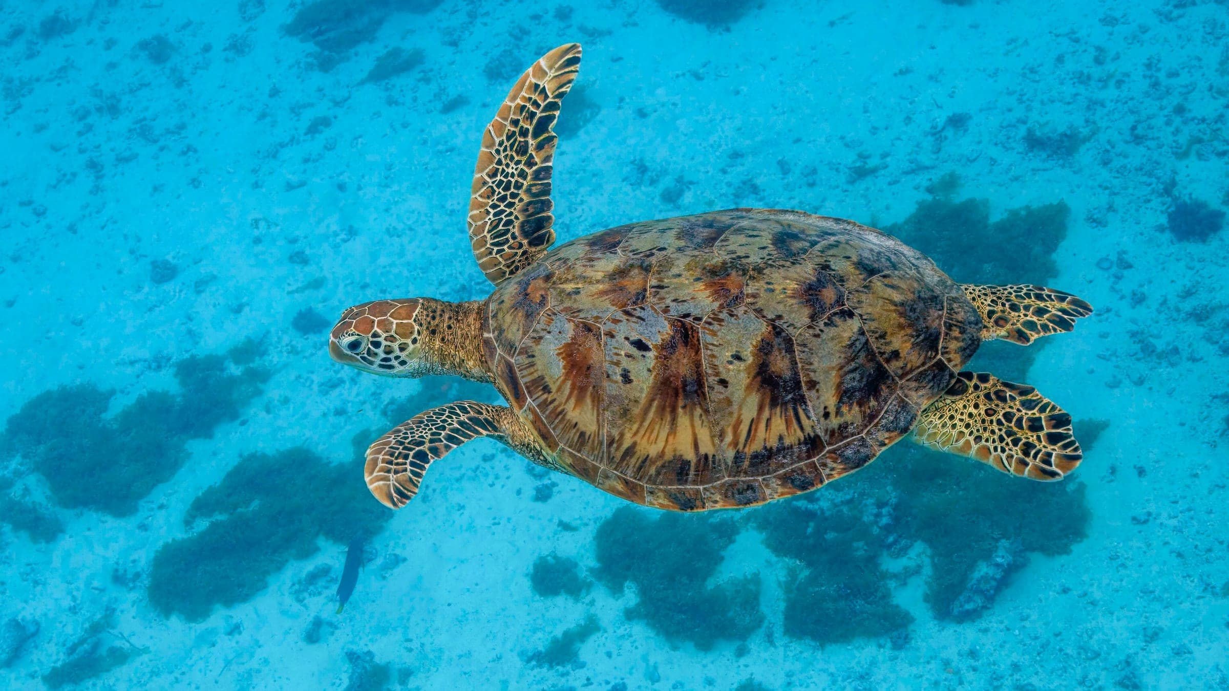
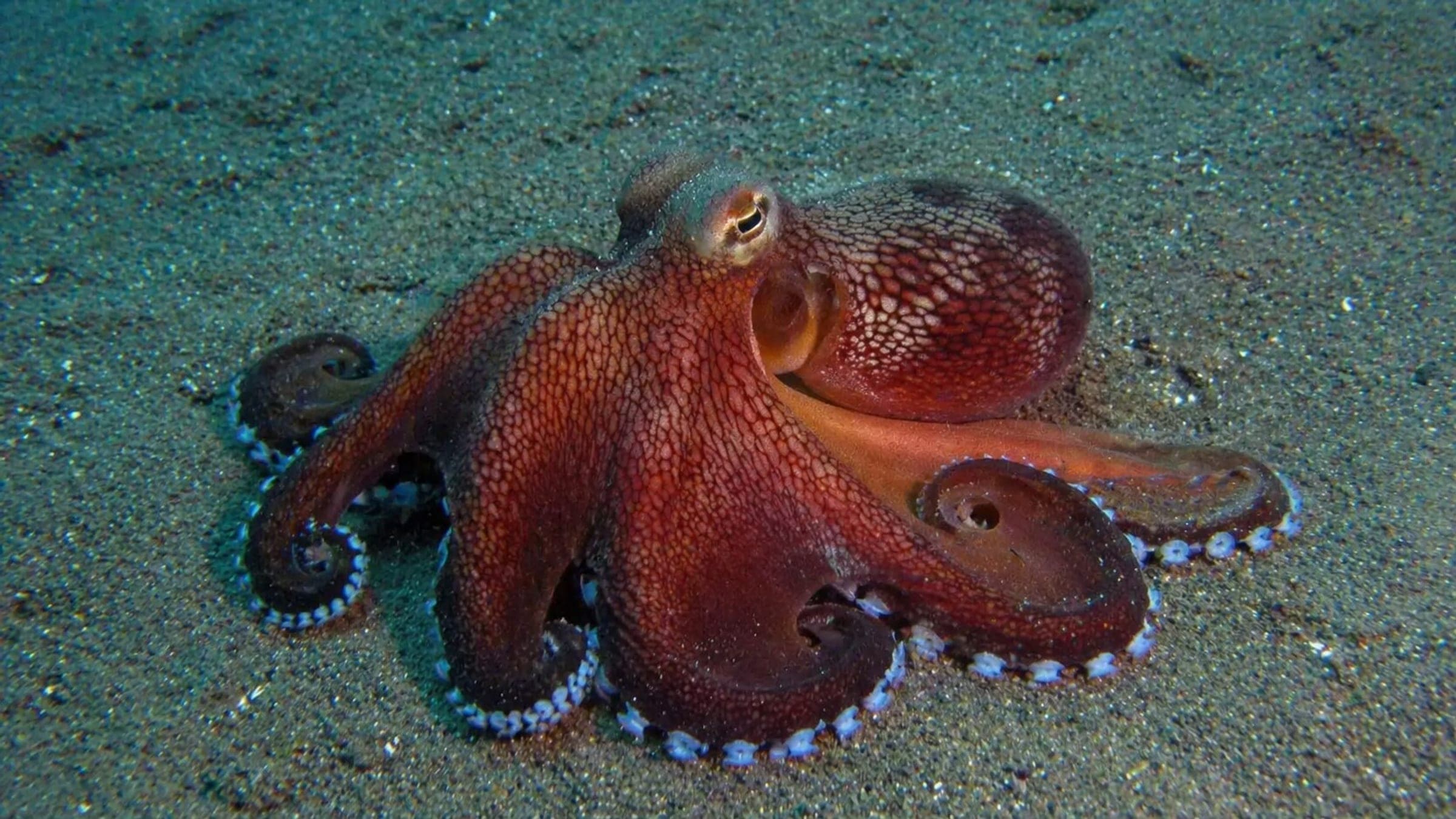
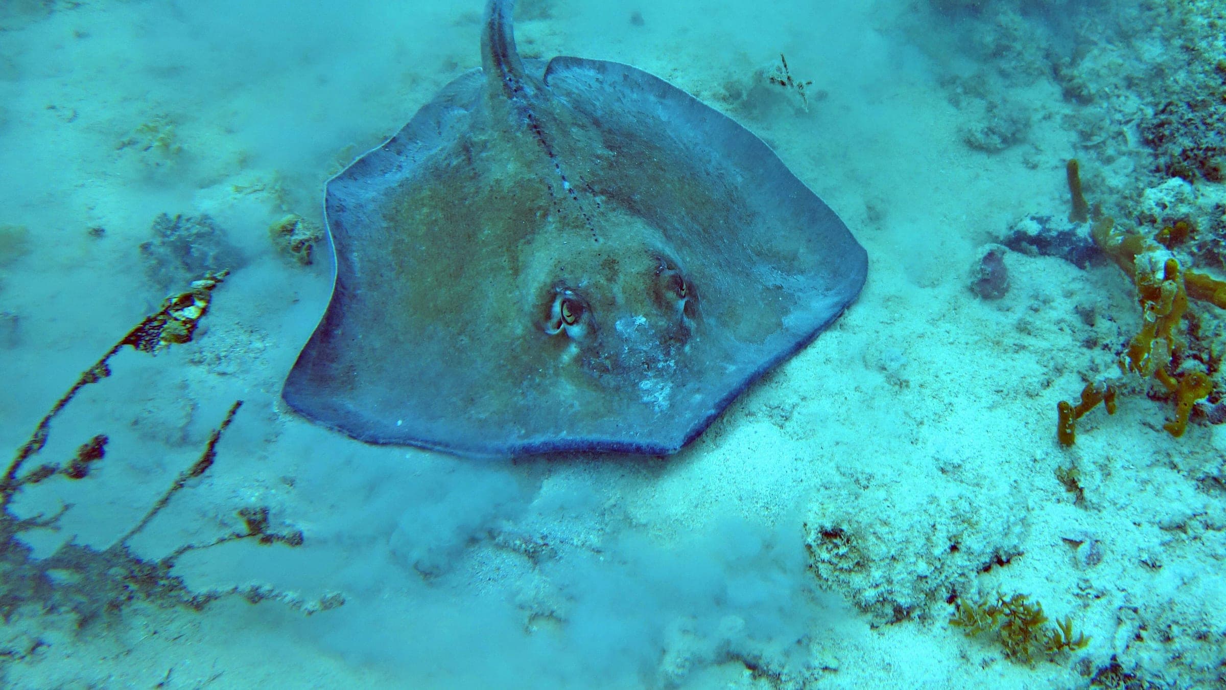
Boat-only bay reef with turtles, rays, and garden eels.
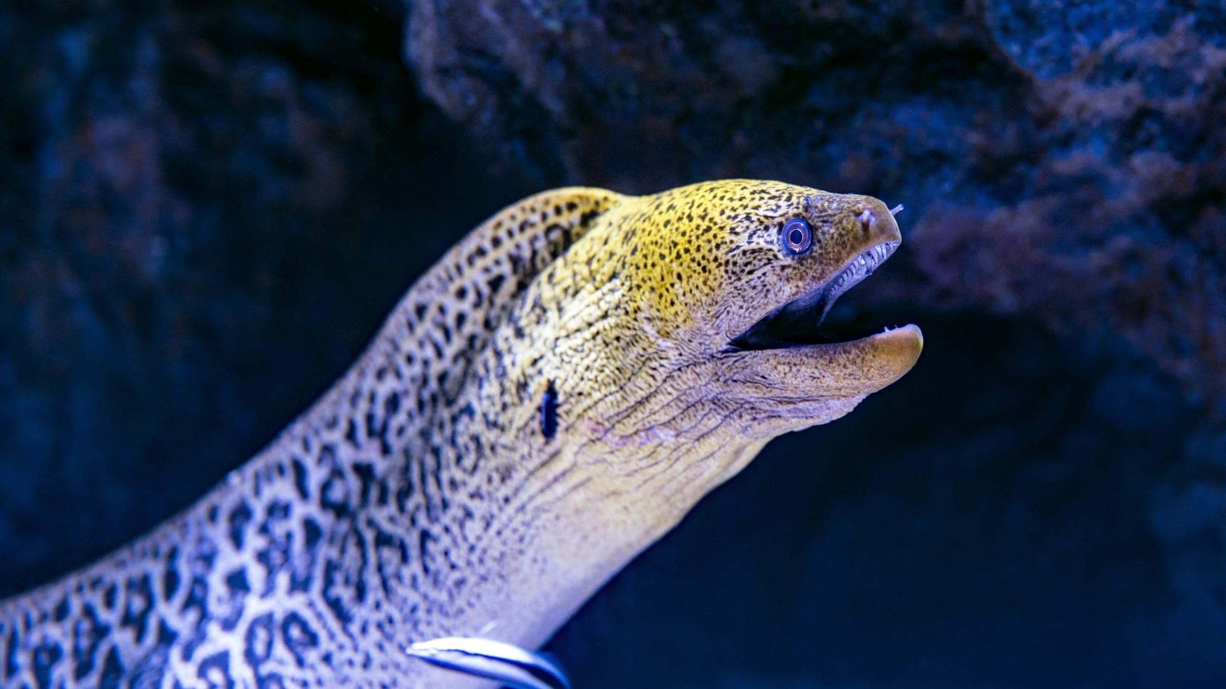
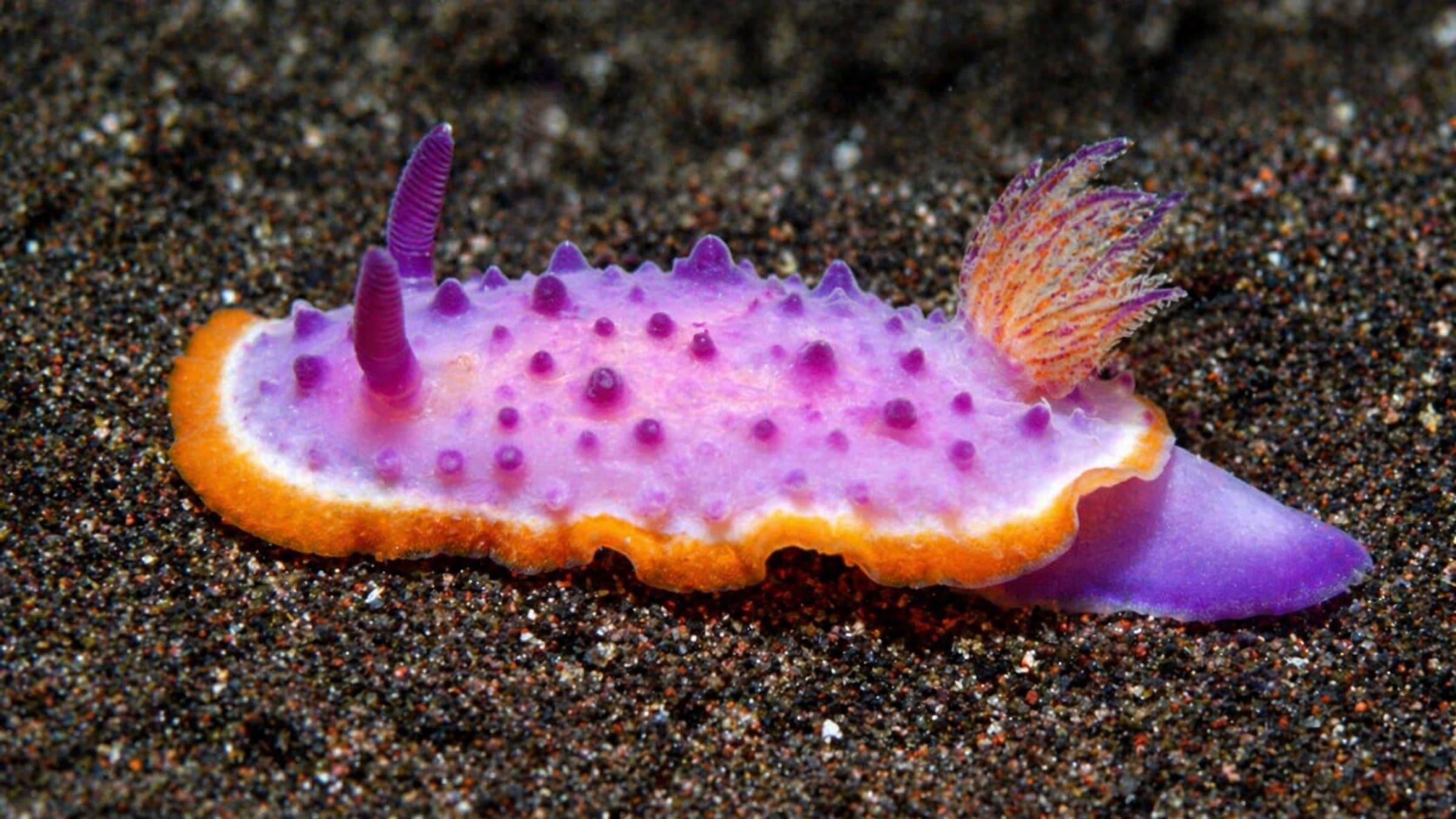
Majahuitas is a remote south-bay dive site reached by boat and usually dived along the sheltered side of a forested point and beach. Underwater, the site mixes rocky reef, boulders, sandy patches, and deeper wall sections, so operators can shape easier routes close to the protected side or longer passes for divers who want a more exposed profile. Divers and snorkelers come here for a relaxed bay setting, schooling reef fish, rays, turtles, eels, and small macro life, with conditions that are often clearest in the warmer part of the year.
Conservative baseline from public research. No community dives logged yet.
Depth range, seasonality, and planning context.
Reported Depth
8m - 33m
Depth Note
Public operator pages describe shallow reef starts around 8 m and deeper wall or drop-off sections reaching roughly 30 to 33 m.
Best Season
Generally diveable year-round, with clearer water commonly reported from late spring through early winter.
Typical Conditions
Expect a sheltered bay-side reef and wall with warmer water for much of the year, mild current on many days, and visibility that can change noticeably with season, swell, and runoff.
Hazards, restrictions, and access requirements.
Safety Notes
Boat diving only. The protected side is commonly used for easier routes, but depth, variable visibility, and more exposed sections outside the lee are the main planning risks, so follow local guide routing and site selection.
Access Restrictions
Boat access only; this is typically visited by guided dive or snorkel trips, and operators may switch sites when weather or sea state makes the run unsuitable.
Community notes to help plan your visit.
Scuba Diving
Common boat-diving routes follow the protected reef first, then extend onto deeper wall sections when conditions allow. It works well for mixed-experience boats because guides can keep newer divers on calmer terrain while experienced divers take longer profiles.
Snorkeling
Majahuitas is also a common snorkel stop thanks to its protected shallows, fish life, and usually calmer surface conditions on the lee side of the bay.
Use the planner to scan this week, inspect today in local time, and understand how exposure shapes conditions at Majahuitas.
Directional shelter context for incoming swell.
Species commonly reported at this site, with direct links into their wildlife guides.
Community dive logs and visit reports for this site.
No Dive Logs Yet
Be the first to log a dive at this spot and share your experience!
Average conditions based on logged dives & visits.
Planning answers for access, conditions, timing, and site logistics.
Last Updated
Research Sources
Tour page used for snorkel suitability, calm-water routing, and broad skill-level guidance.
Operator page used for depth range and seasonal visibility guidance.
Dive-site description used for access mode, underwater layout, and commonly reported marine life.
Beach and cove overview used for access context and sheltered-bay character.
Know this site? Improve Spot Details.

Protected granite-arch and reef dive zone south of Puerto Vallarta.
Princesa Vallarta Shipwreck: deep boat wreck in Banderas Bay
Protected boat dive around volcanic islands and reef edges.