en.wikivoyage.org · Community Guide
Boat-only access, sheltered anchorage and site layout.
Hout Bay seal colony boat dive with shallow kelp
Boat-only access from Hout Bay; local seal-trip operators handle the permit-controlled entry.
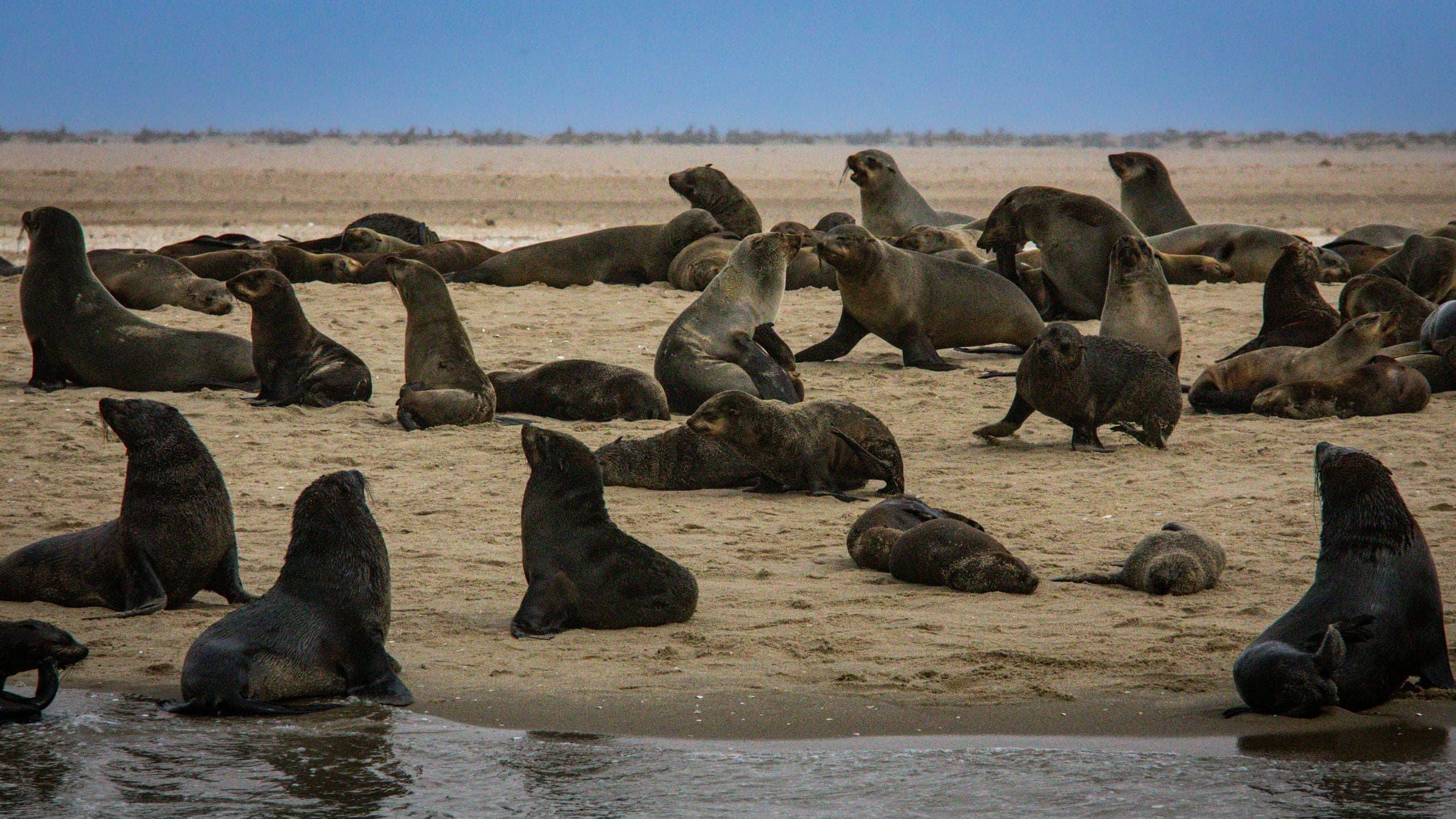
Duiker Island is the Hout Bay seal colony stop: a tiny rocky islet where the main draw is close Cape fur seal encounters over a shallow, kelp-fringed anchorage in the island's lee. The bottom is granite and rock rather than sand, so the underwater plan is simple and the wildlife does the heavy lifting. Expect a short boat transfer, cold water and a busy marine-tour setting. It suits calm-day snorkelling or an easy scuba stop, but the real constraints are swell, boat traffic and a need to keep the channel clear.
Conservative baseline from public research. No community dives logged yet.
Depth range, seasonality, and planning context.
Reported Depth
0m - 6m
Depth Note
The sheltered inshore anchorage is around 6 m deep, with very shallow kelp and rock nearby.
Best Season
year round, with calmer summer windows
Typical Conditions
The anchorage is partly protected by a ridge to the south-west, but south-westerly and very westerly swell can make it dangerous.
Hazards, restrictions, and access requirements.
Key Hazards
Safety Notes
Keep clear of the turnaround channel, expect cold wind on the boat, and watch for surge if the swell is south-westerly or very westerly.
Access Restrictions
Boat only; TMNP MPA permit required; use a trip that includes water access rather than a view-only cruise.
Legal Notes
The site sits in the TMNP MPA and the Karbonkelberg headland area, so current marine rules and boat controls apply.
Community notes to help plan your visit.
Scuba Diving
Shallow boat dive over granite and kelp with seals overhead; keep the route simple and avoid the channel.
Freediving
Possible for confident freedivers, but the site is more of a seal snorkel stop than a dedicated breath-hold route.
Snorkeling
This is the classic use case: short boat transfer, shallow water and close seal encounters when the sea is calm.
Use the planner to scan this week, inspect today in local time, and understand how exposure shapes conditions at Duiker Island.
Directional shelter context for incoming swell.
Species commonly reported at this site, with direct links into their wildlife guides.
Community dive logs and visit reports for this site.
No Dive Logs Yet
Be the first to log a dive at this spot and share your experience!
Average conditions based on logged dives & visits.
Planning answers for access, conditions, timing, and site logistics.
Last Updated
Research Sources
Boat-only access, sheltered anchorage and site layout.
Visibility around Hout Bay and Duiker Island approach.
Seal Island alias and Hout Bay boat-trip context.
TMNP MPA recreation and scuba permit context.
Year-round visit guidance and tourist context.
Know this site? Improve Spot Details.

Granite cave-and-kelp shore dive with tricky Atlantic entry.