www.mecklenburgische-seenplatte.de · Official Tourism
Clear-water reputation, summer clarity, and dive-station mention.
Steep freshwater shore dive with boulders and cover
Save it, log a dive, or explore nearby on the map.
Save it to come back later
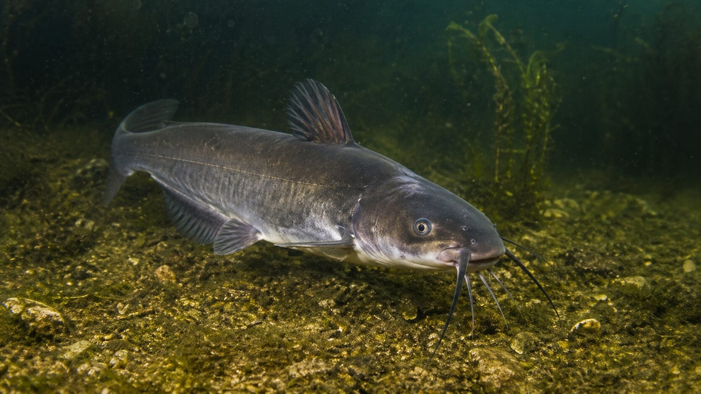
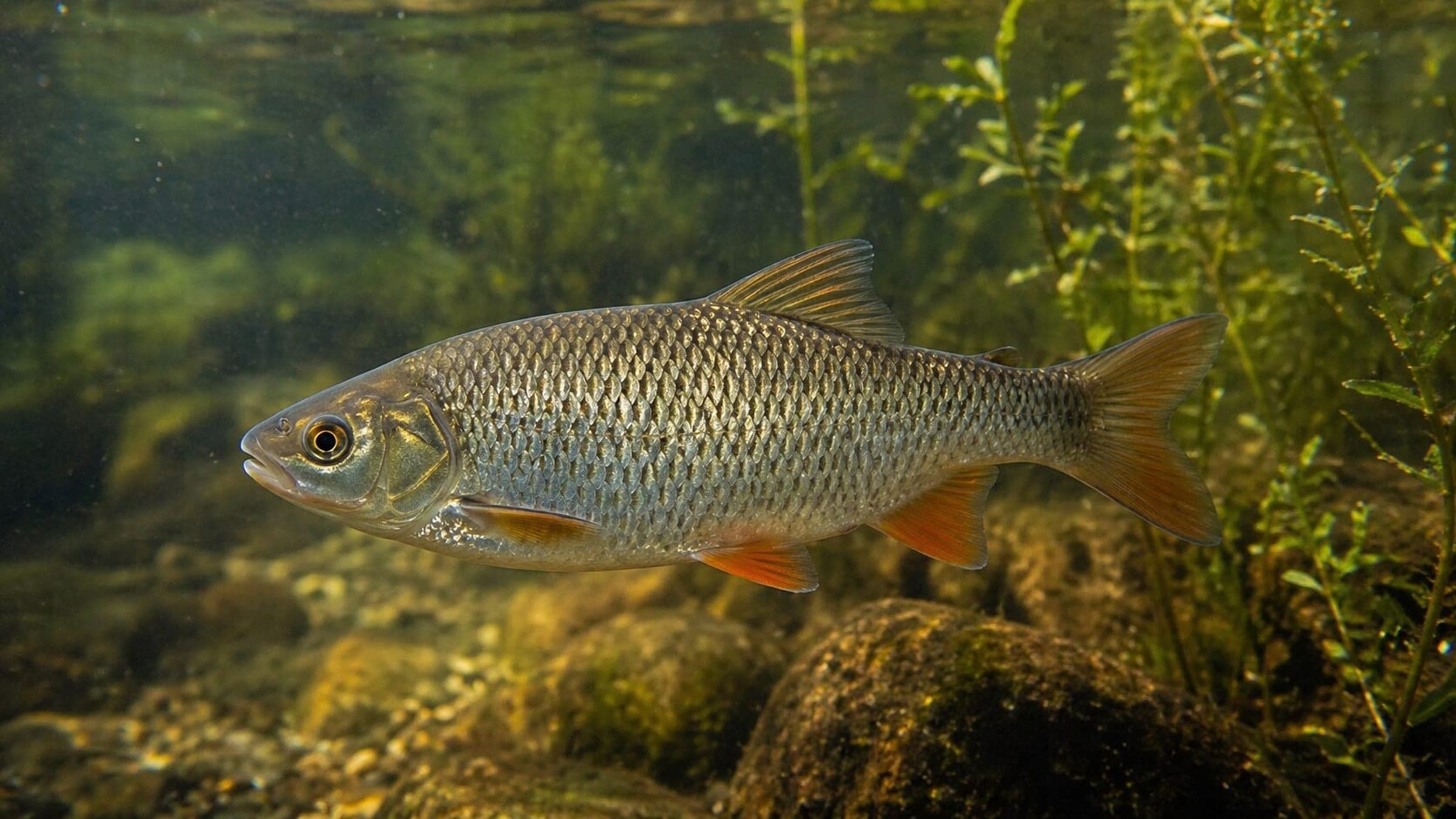
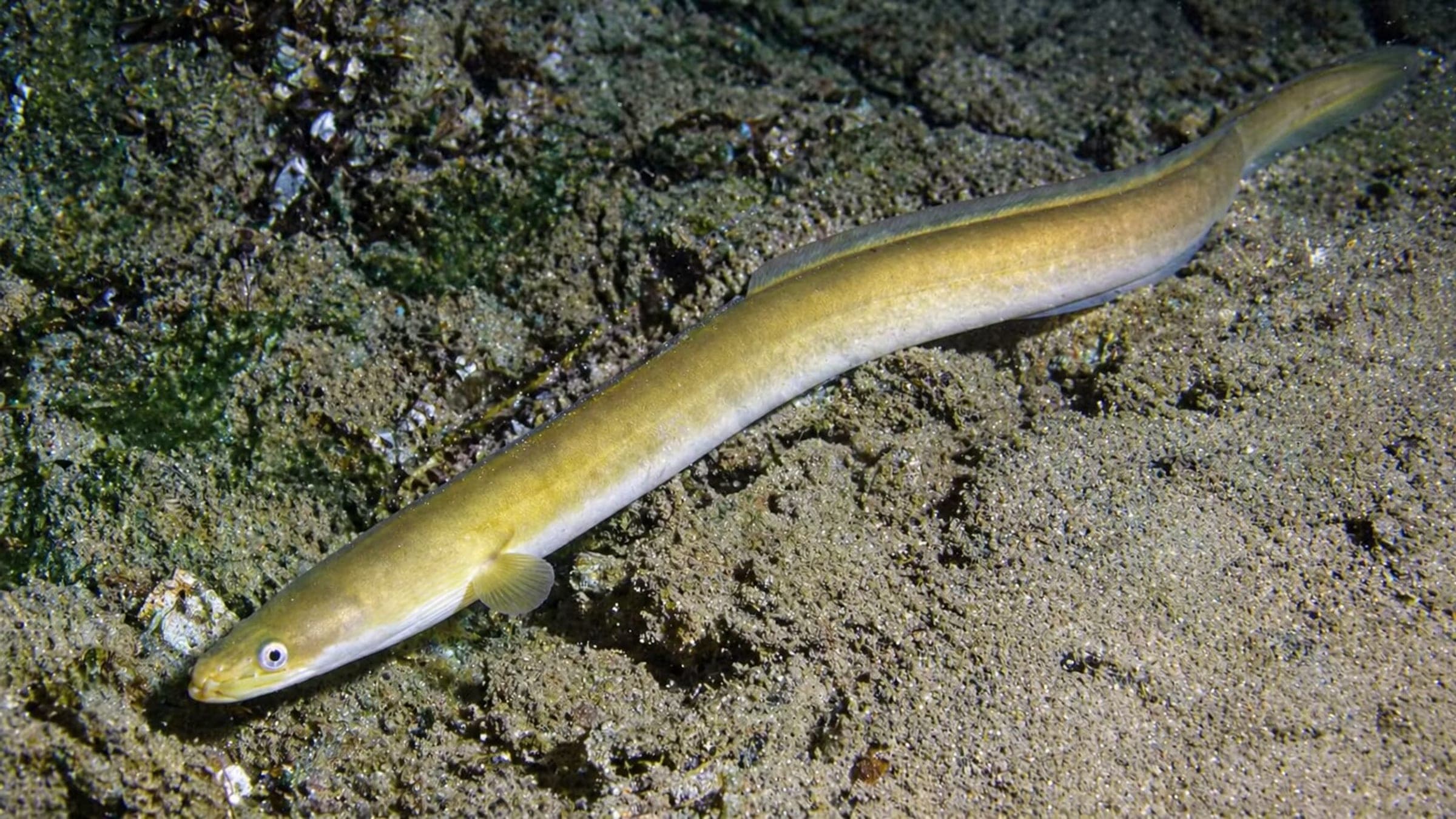
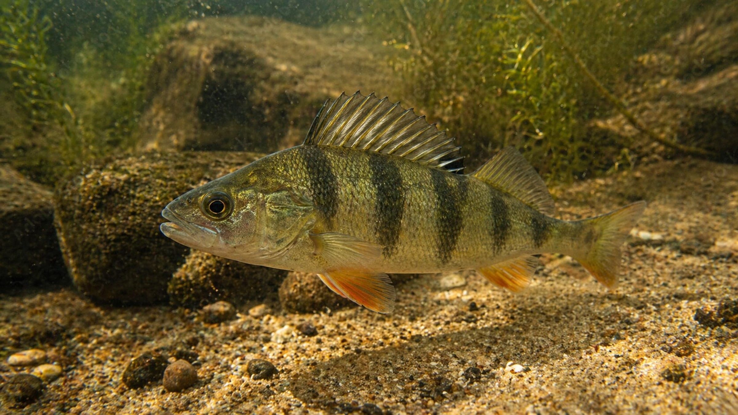
A steep freshwater shore dive with boulders, rocky and sandy patches, scattered historic debris, and tree cover that shelter fish along the lake edge. Access starts from a paid parking area and drops to the water by stairs or a car path, so it suits divers comfortable with a carry-heavy shoreline approach and calm inland-lake conditions.
Conservative baseline from public research. No community dives logged yet.
Depth range, seasonality, and planning context.
Reported Depth
Up to 15m
Depth Note
Maximum depth is approximately 15 m.
Best Season
summer
Typical Conditions
Calm, cool freshwater with variable but often clear visibility; the shoreline approach is the main planning factor.
Hazards, restrictions, and access requirements.
Key Hazards
Safety Notes
Downed trees and debris can create snag or entanglement risks; the stair or car-path approach also needs careful footing with dive gear.
Access Restrictions
Plan for a gear carry down and back up; the entry is a shore walk-in rather than a flat beach approach.
Legal Notes
The lake sits in a protected area, so follow posted shoreline and boating rules and keep clear of sensitive habitat.
Community notes to help plan your visit.
Scuba Diving
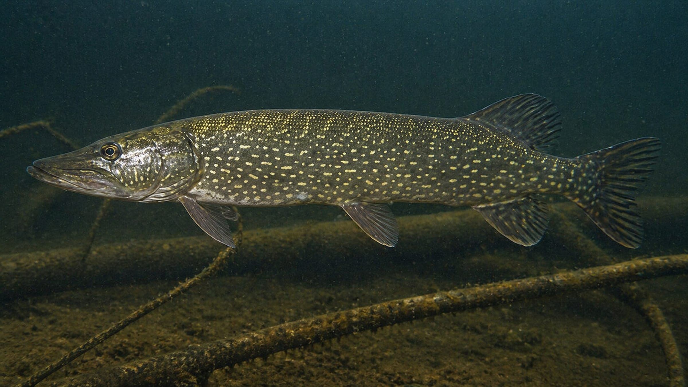
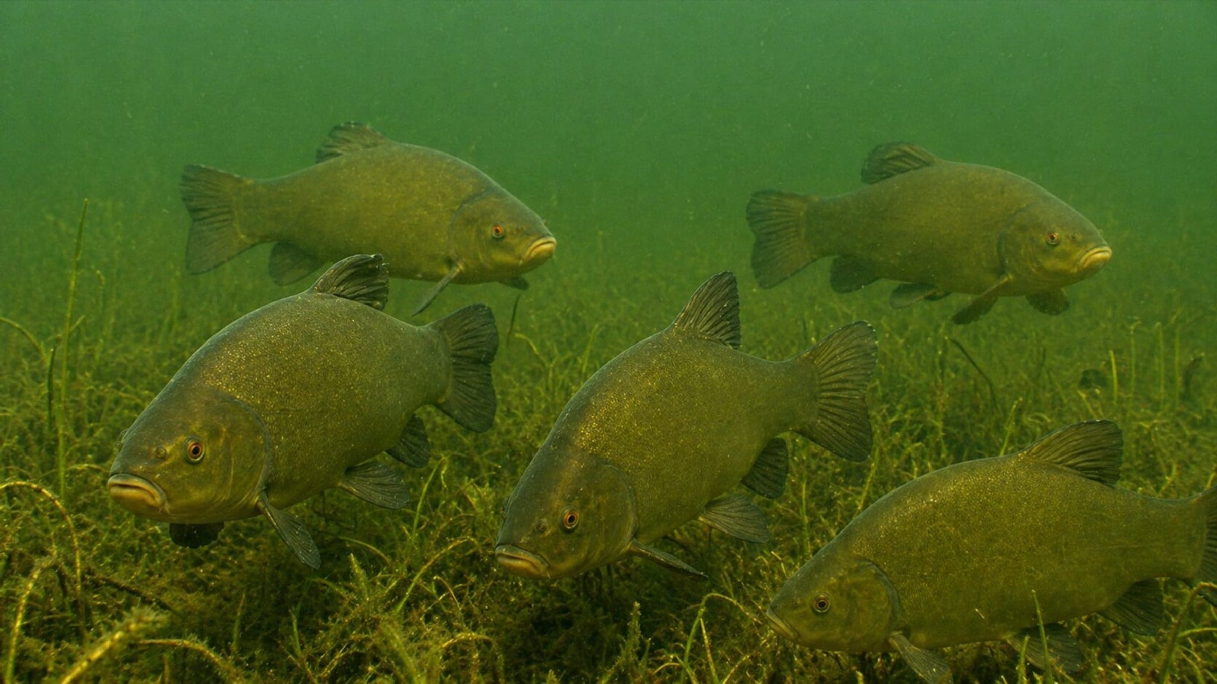
Boulders, woody cover, rocky and sandy bottom, and scattered debris make this a relaxed freshwater exploration dive.
Freediving
The shallow shoreline water can work for short freedive sessions, but the long stair or car-path carry makes it more of a scuba shore dive.
Snorkeling
Short snorkel sessions are possible in the calm shallows, but the site is better treated as a dive entry than a snorkel destination.
Use the planner to scan this week, inspect today in local time, and understand how exposure shapes conditions at Schmaler Luzin Fähre.
Directional shelter context for incoming swell.
Species commonly reported at this site, with direct links into their wildlife guides.
Community dive logs and visit reports for this site.
No Dive Logs Yet
Be the first to log a dive at this spot and share your experience!
Average conditions based on logged dives & visits.
Planning answers for access, conditions, timing, and site logistics.
Last Updated
Research Sources
Clear-water reputation, summer clarity, and dive-station mention.
Protected-area context and boating restriction context.
Local dive-center visibility and site-structure context.
105-step entry, tree cover, and freshwater fauna.
Know this site? Improve Spot Details.

Schmaler Luzin is a lake dive with steep access and sponge-covered timber.
Carwitzer Becken is a steep freshwater basin dive with easy shore entry.
Freshwater shore entry at Carwitz on Schmaler Luzin.
Tauchbasis Thomsdorf is a shore training base on Carwitzer See.
Relaxed freshwater lake dive with training platforms and easy access.
A cold freshwater lake dive with torpedo-era wreckage.