

www.divers-guide.com · Dive Directory
Independent directory with visibility, current, access, and marine-life baseline.
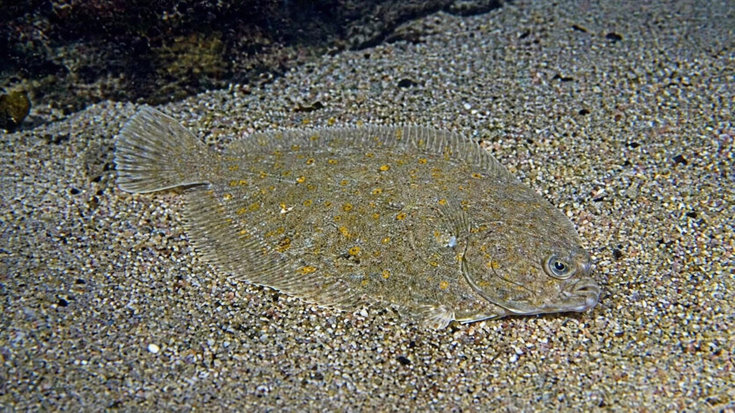
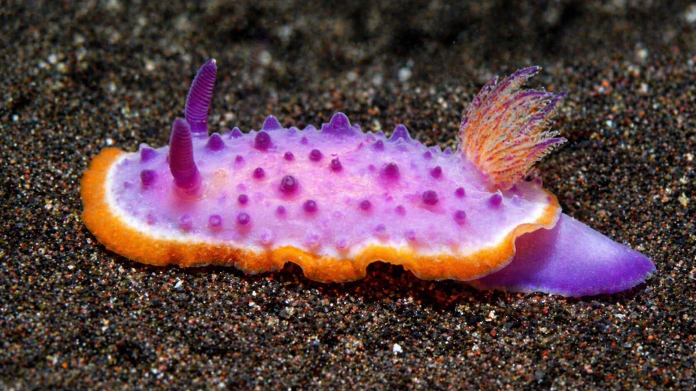
Shore dive with slopes, caves, and winter nudibranchs
Lyngsbo Strand is a Lillebælt shore dive with a short walk from parking to a shallow sand-and-eelgrass entry. The route drops into broken slopes and small caves, then opens onto a current-sensitive outer wall that rewards tight turnaround planning and a visible surface marker. It works for relaxed scuba and snorkel sessions on calmer days, and winter is the best time to look for nudibranchs and other small life.
Conservative baseline from public research. No community dives logged yet.
Depth range, seasonality, and planning context.
Reported Depth
6m - 25m
Depth Note
Public dive maps place the main route from a shallow sandy entry into slopes and a deeper outer section; 25 m is the conservative published maximum.
Best Season
All year; winter is the best time for nudibranchs.
Typical Conditions
Shallow sand and eelgrass at the start, then small rocks, slopes, and caves on a current-sensitive outer route.
Hazards, restrictions, and access requirements.
Key Hazards
Safety Notes
Use a surface marker and stay clear of the belt. The current can build as you move out, and sailing close to shore is a year-round factor.
Access Restrictions
Free access, but the public dive maps warn against entering between the marked hazard points and against diving inside the harbour area.
Legal Notes
No permit is listed on the public dive-map listings.
Community notes to help plan your visit.
Scuba
Best as a shore-based out-and-back dive that keeps the turn conservative once the slope and current start to increase.
Snorkel
Possible in the shallows on calm days, but the current and boat traffic make it a better choice for experienced snorkelers.
Chill / Non-diver
A relaxed local dive for short sessions, macro hunting, and easy shore access when conditions are calm.
Use the planner to scan this week, inspect today in local time, and understand how exposure shapes conditions at Lyngsbo Strand.
Directional shelter context for incoming swell.
Species commonly reported at this site, with direct links into their wildlife guides.
Community dive logs and visit reports for this site.
Be the first to log a dive at this spot and share your experience!
Average conditions based on logged dives & visits.
Planning answers for access, conditions, timing, and site logistics.
Last Updated
Research Sources
Independent directory with visibility, current, access, and marine-life baseline.
Local dive-map entry with access, depth, facility, and species notes.
Site name, route shape, entry point, and public hazard wording for Lyngsbo Strand.
Regional dive map that repeats the site name, depth range, and beginner-friendly level.
Know this site? Improve Spot Details.

Popular wall dive with a marked shore entry
Bridge-pier dive with easy shore access and current
Shore dive with soft sand and a deeper pier end