dr1.com · Travel Guide
Regional Samaná guide confirming El Ferry near Cayo Levantado and the winter whale-season context.
Shallow Samaná wreck with easy lines and fish life.
Shallow Samaná wreck with easy lines and fish life.
Save it, log a dive, or explore nearby on the map.
Save it to come back later
Boat access and line-based entry make a local operator the practical default.
A shallow wreck in Samaná Bay near Cayo Levantado with easy line-based access, a compact hull, and fish-filled cavities. The site is simple to read underwater and works well as a relaxed wreck stop, with snorkeling possible when the bay is calm.
Conservative baseline from public research. No community dives logged yet.
Depth range, seasonality, and planning context.
Reported Depth
10m - 11m
Depth Note
Wreck sits at about 10 m, with a maximum depth around 11 m and descent lines at both ends.
Best Season
Winter, especially January to March, when the bay is calmest and visibility tends to improve.
Typical Conditions
Sheltered bay wreck with easy line descents, moderate visibility, and calmer winter water.
Hazards, restrictions, and access requirements.
Key Hazards
Safety Notes
Use the descent lines, stay aware of the overhead space beneath the hull, and keep clear exit lanes while exploring the cavities.
Access Restrictions
Boat access from Samaná Bay; use the descent lines and a local operator familiar with the wreck.
Legal Notes
Follow the operator briefing and keep to the line-based entry pattern around the wreck.
Community notes to help plan your visit.
Scuba Diving
An easy wreck dive at shallow depth with areas to swim beneath the hull and explore small cavities.
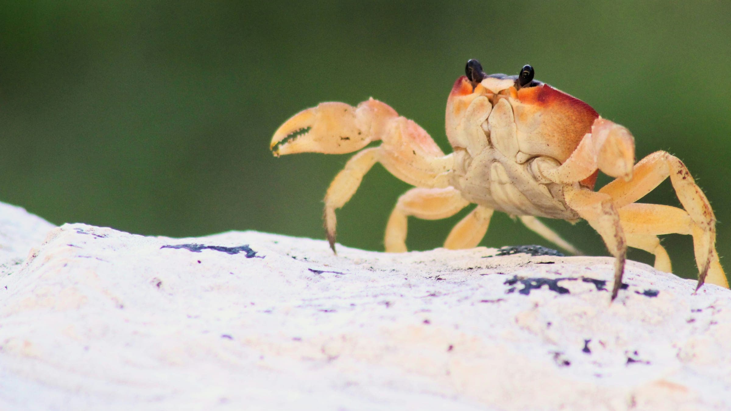
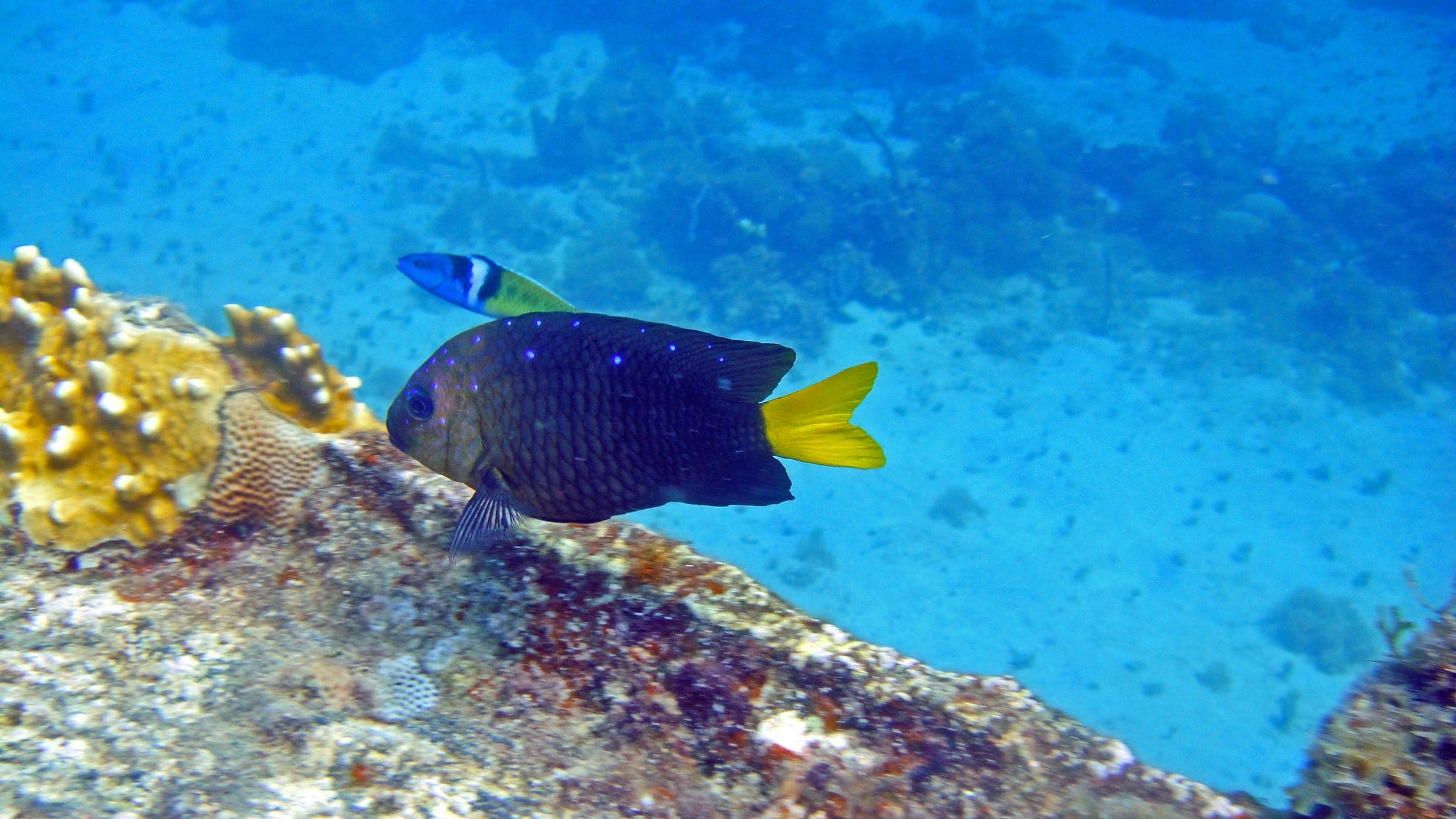
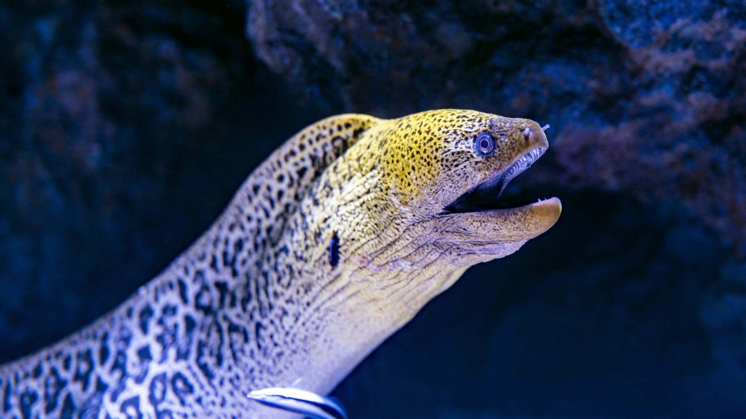
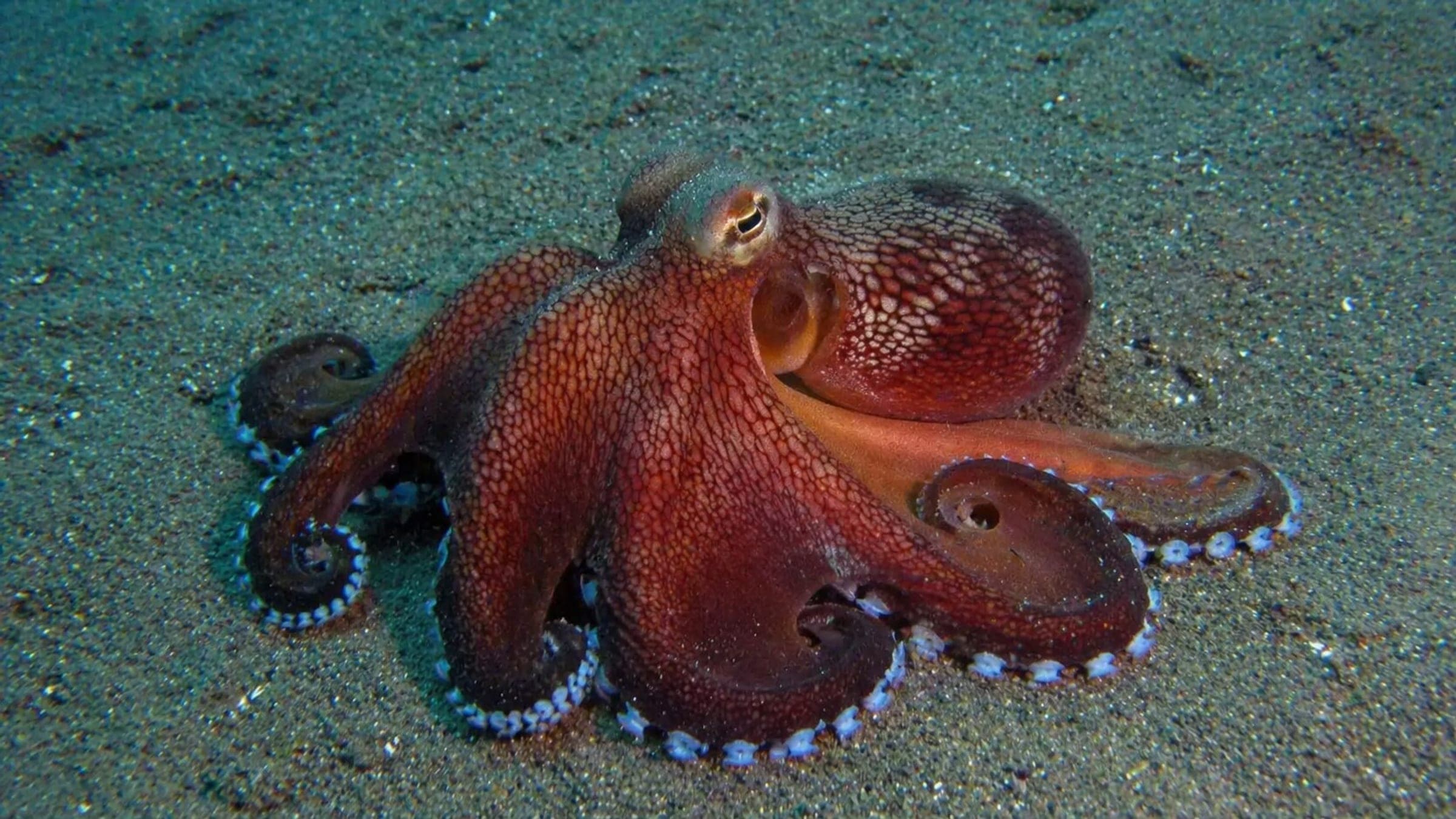
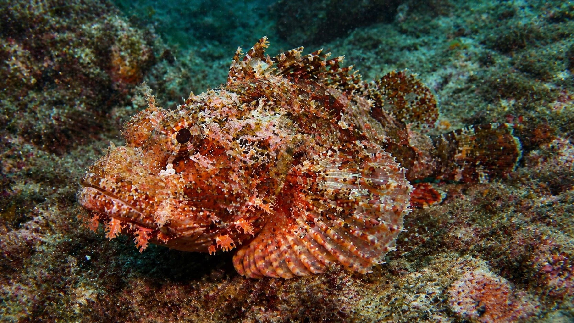
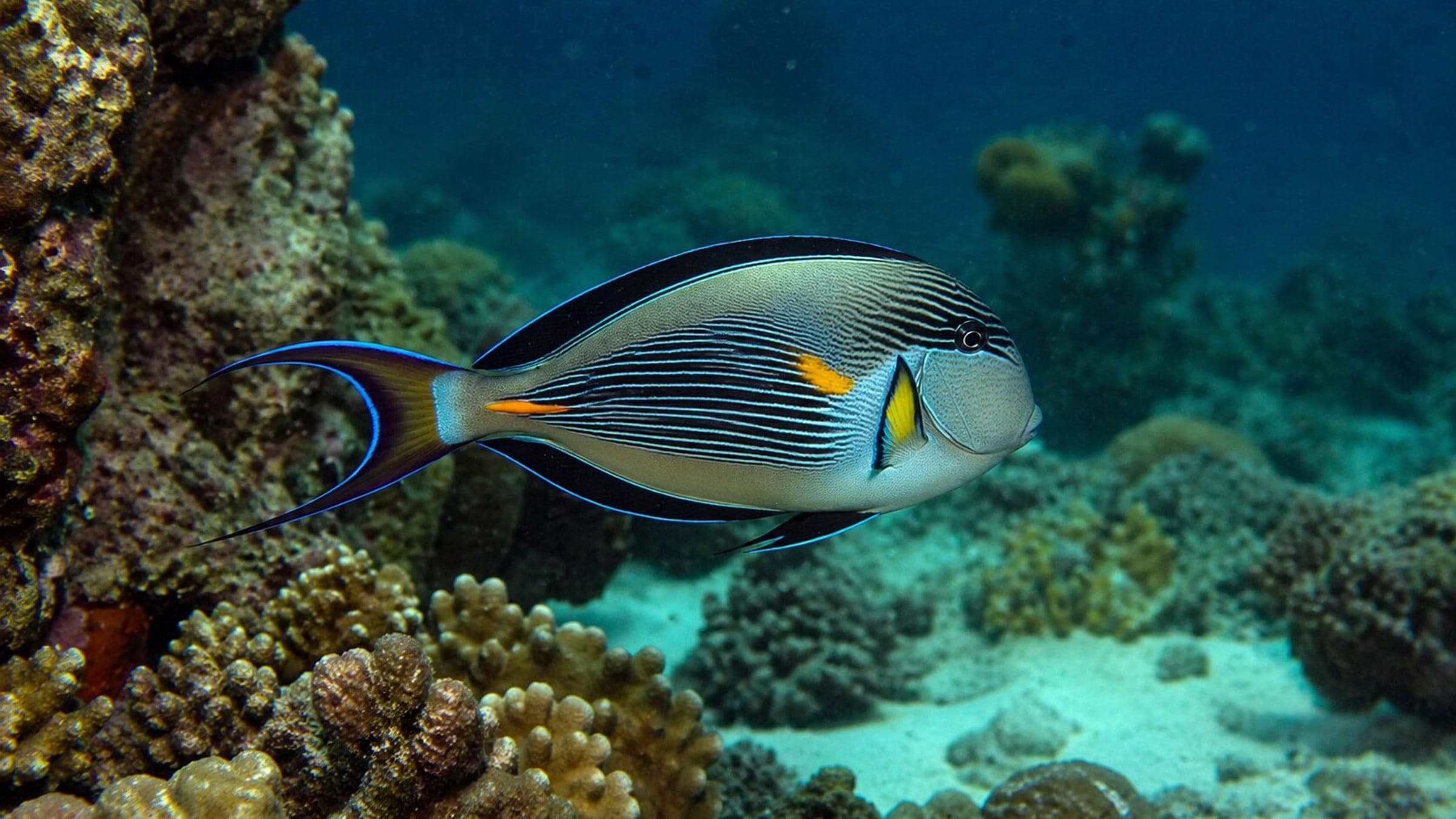
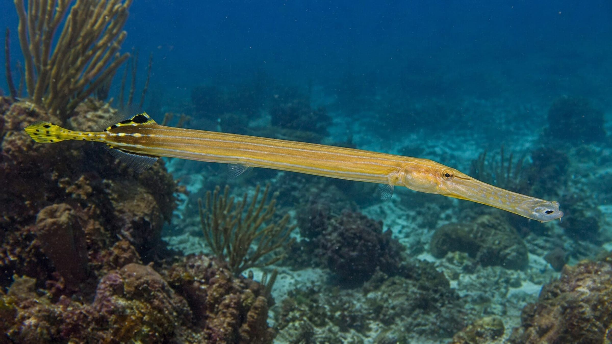
Species commonly reported at this site, with direct links into their wildlife guides.
Community dive logs and visit reports for this site.
Average conditions based on logged dives & visits.
Planning answers for access, conditions, timing, and site logistics.
Last Updated
Research Sources
Regional Samaná guide confirming El Ferry near Cayo Levantado and the winter whale-season context.
Boat access from Samaná Bay, shallow wreck depth, and snorkel-friendly conditions.
Know this site? Improve Spot Details.

Boat-access wall dive with holes, rays, and snappers
Samaná wall with coral, blue water, and marine life.
Advanced offshore rock dive with strong current and sharks
Dolphin (Wreck): advanced wreck dive with open sections.
Boat-dived reefs, canyons, and caverns off Las Terrenas.
A Las Terrenas reef line with a small wreck and sea fans.