nds-malta.com · Operator
Published Jul 2, 2020Historic operator page with the Manoel Island location, sheltered harbour setting, short shore swim, shallow bow/deeper stern, and named wreck species.
Lighter X127: historic Manoel Island wreck with easy shore access.
Local logistics are the normal way to plan this harbour wreck because the access route uses stairs or a ladder rather than a casual beach entry.
Lighter X127 is a sheltered Manoel Island wreck dive in Marsamxett Harbour, approached as a shore dive with a short swim to an almost-intact landing lighter. The profile starts shallow and drops toward a deeper stern, so it works as a wreck exploration dive for divers who want a historic site with straightforward logistics but still need calm buoyancy, because harbour silt and surface traffic are the main planning variables.
Conservative baseline from public research. No community dives logged yet.
Depth range, seasonality, and planning context.
Reported Depth
5m - 22m
Depth Note
The bow is shallow and the stern sits deeper on the slope, with the wreck reported between about 5 m and 22 m.
Best Season
Year-round, with sheltered-weather windows offering the easiest conditions.
Typical Conditions
Sheltered harbour wreck with a gentle slope, silt on the bottom, and visibility that can swing when the seabed is disturbed.
Hazards, restrictions, and access requirements.
Key Hazards
Safety Notes
Do not plan wreck penetration. The wreck is old and silty, and the long cable plus scattered debris make buoyancy and trim important.
Access Restrictions
Shore access is easier via the harbour/stairs-or-ladder route than as a casual beach entry, so check local access and site handling before going.
Legal Notes
Treat the wreck as protected heritage: it is described as an official war memorial and a Maltese Maritime Law site, so do not disturb or remove artifacts.
Community notes to help plan your visit.
Scuba Diving
Historic wreck dive with an almost-intact landing lighter, a shallow bow, and a deeper stern; best kept to outside exploration rather than penetration.
Freediving
Not a primary freedive target; the wreck is better approached on scuba with buoyancy control and a measured pace.
Snorkeling
Not a natural snorkel focus, since the main draw is the submerged wreck rather than a surface route.
Use the planner to scan this week, inspect today in local time, and understand how exposure shapes conditions at Lighter X127.
Directional shelter context for incoming swell.
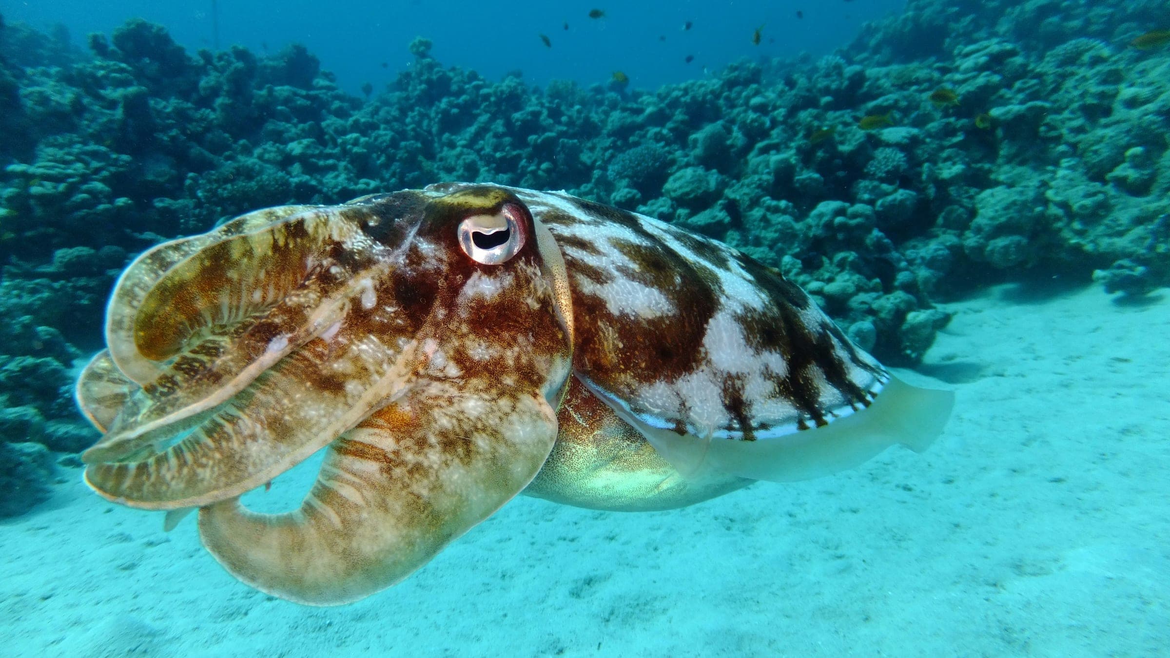
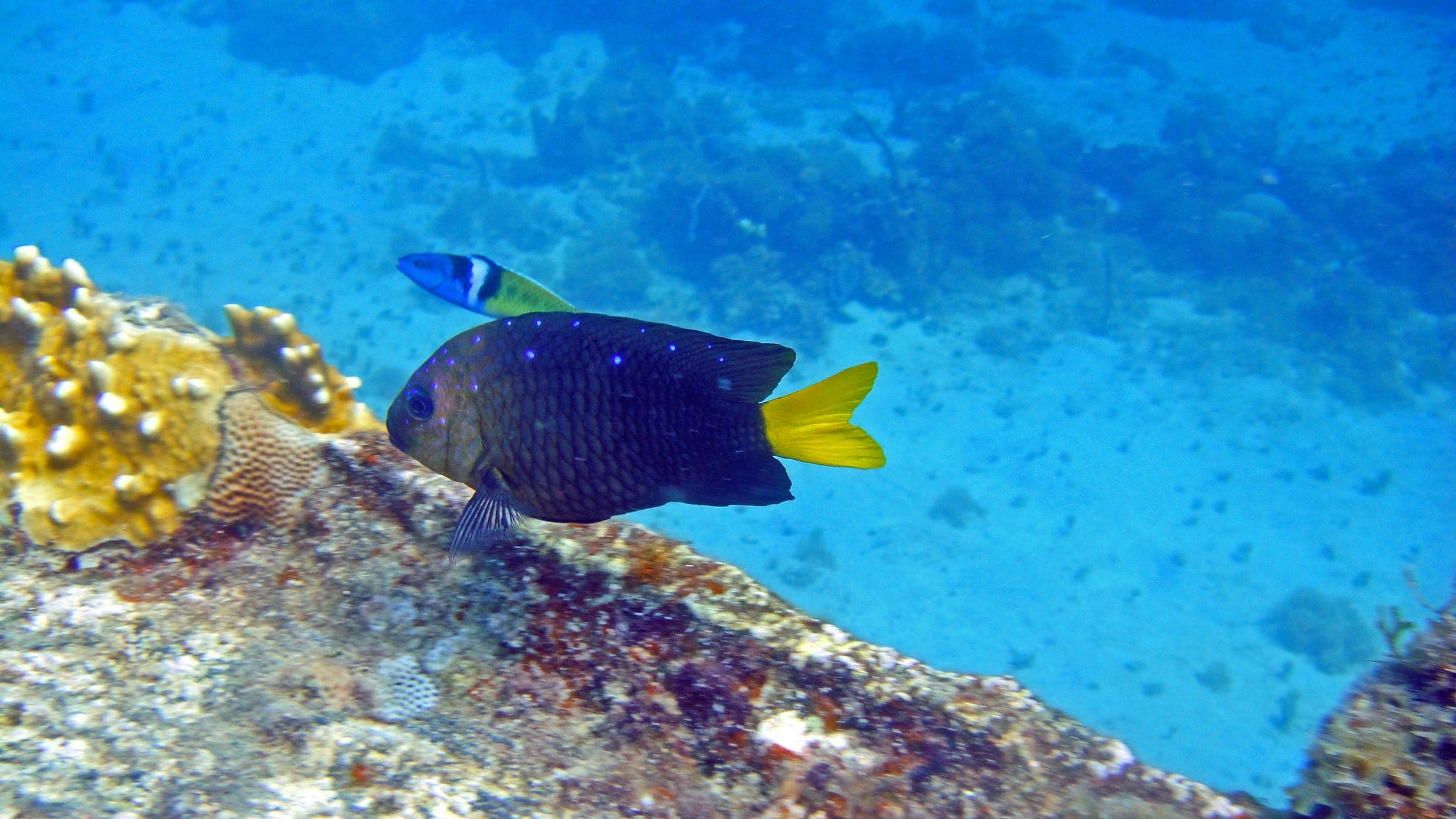
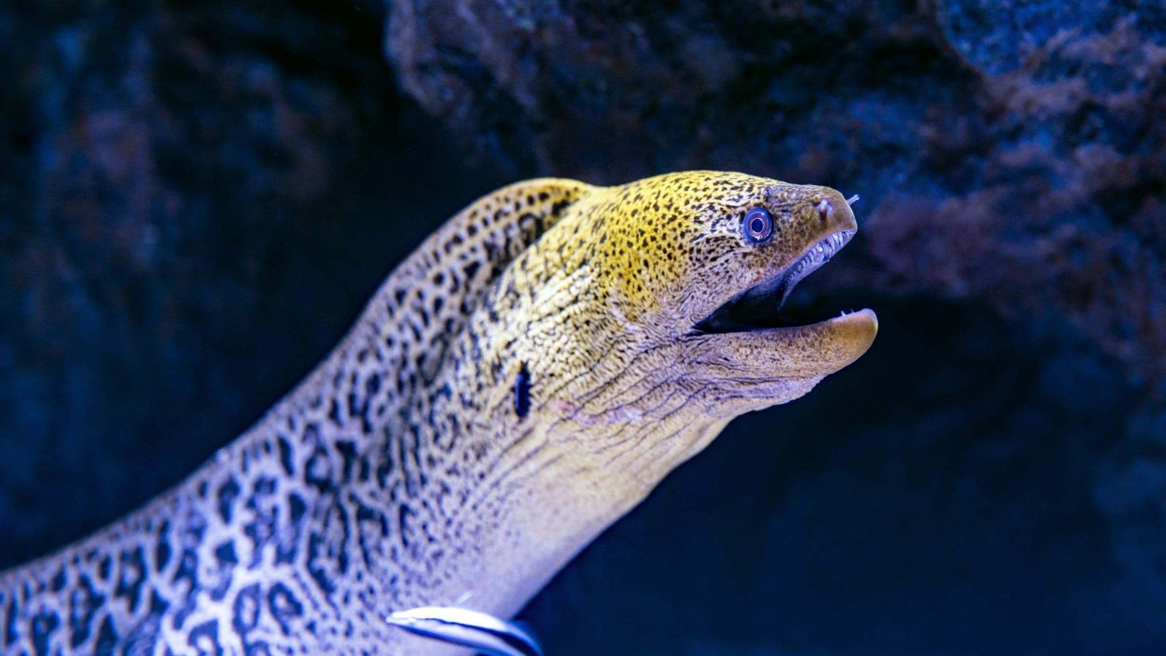
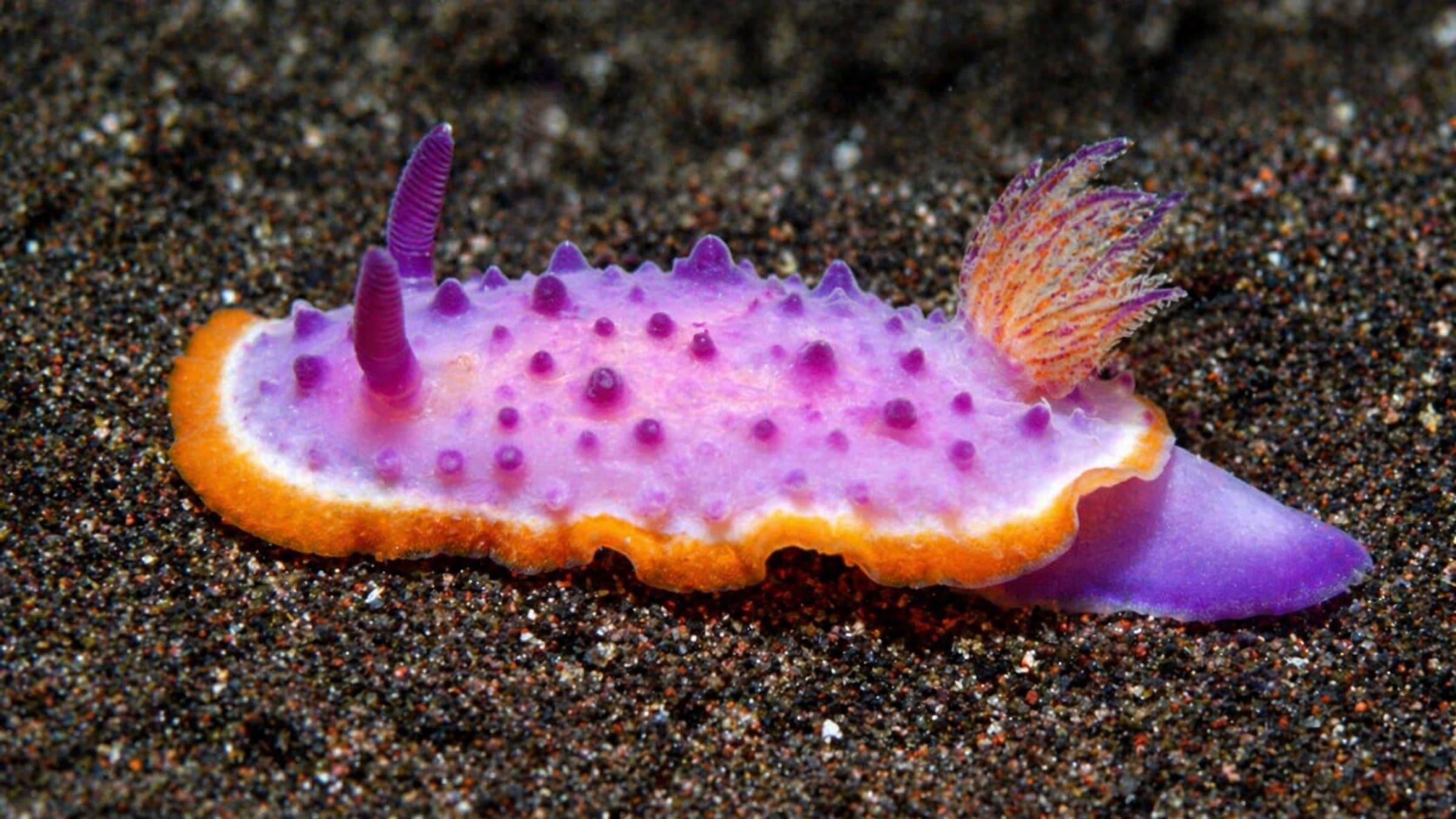
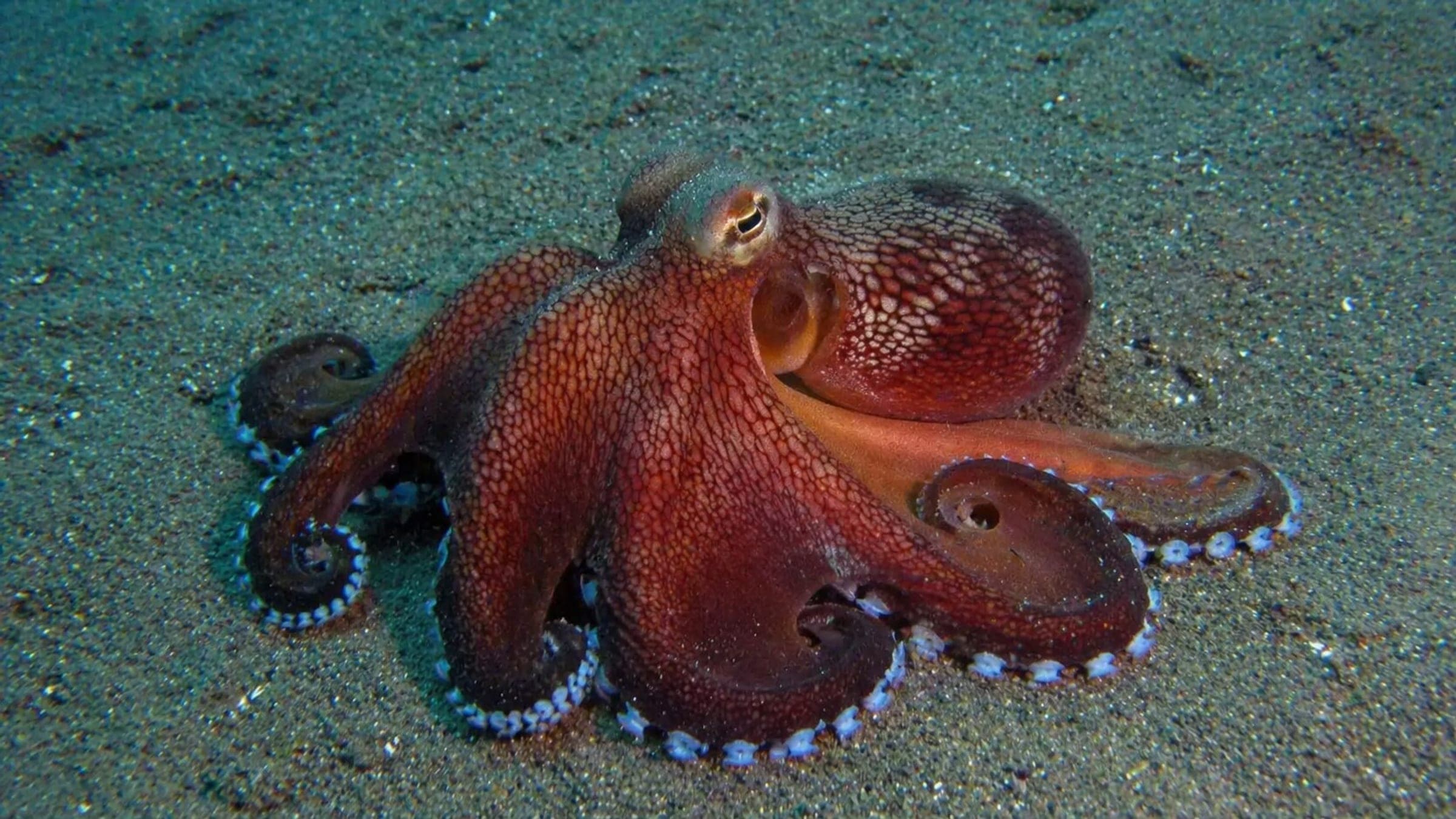
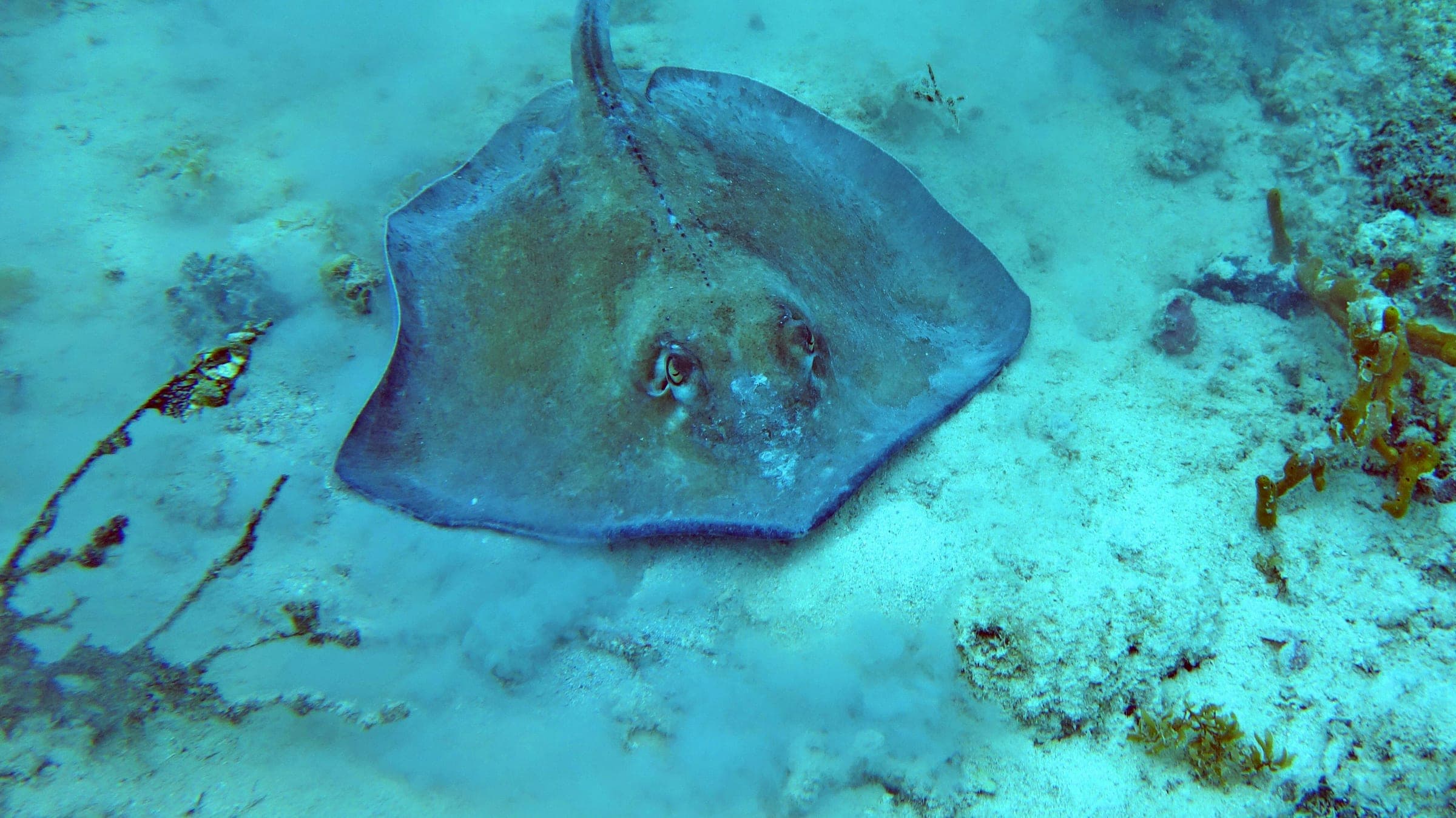
Species commonly reported at this site, with direct links into their wildlife guides.
Community dive logs and visit reports for this site.
Be the first to log a dive at this spot and share your experience!
Average conditions based on logged dives & visits.
Planning answers for access, conditions, timing, and site logistics.
Last Updated
Research Sources
Historic operator page with the Manoel Island location, sheltered harbour setting, short shore swim, shallow bow/deeper stern, and named wreck species.
Directory page with the 5-15 m visibility band, 10 m average visibility, zero current, marina parking, stairs-or-ladder access, and harbour-traffic warnings.
Second operator page that matches the X127 wreck profile and uses the Carolita/Coralita alias.
Historical page placing X127 at Manoel Island in Marsamxett Harbour and noting Maltese Maritime Law status.
Know this site? Improve Spot Details.
HMS Maori: shallow shore-access wreck on sand.
Ta Xbiex: sheltered harbour dive with easy shore access.
Shallow Sliema reef with canyons, tunnels, and photo potential.
Mv Imperial Eagle: deep wreck with a nearby statue.
Artificial-reef ferry wreck off Malta for advanced scuba.